An Exact Chart of the River St. Laurence, from Fort Frontenac to the Island of Anticosti shewing the Soundings, Rocks, Shoals &c. with Views of the Lands and all necessary Instructions for navigating that River to Quebec...

Collection: Smith Collection

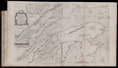
Name: An Exact Chart of the River St. Laurence, from Fort Frontenac to the Island of Anticosti shewing the Soundings, Rocks, Shoals &c. with Views of the Lands and all necessary Instructions for navigating that River to Quebec...

Barcode: 1986

Creator: Jefferys, Thomas, 1710-1771

Date Published: May 25th, 1775

Content: Graphic

Subjects: Navigation

Publisher: Robert Sayer and John Bennett (Firm)

Language: English

Region Depicted: Atlantic Coast (North America)Labrador, CanadaNew EnglandNova ScotiaQuébec, CanadaSt. Lawrence River

Dimensions: Map: H 59.5 x W 94.5 cm on sheet: H 64.5 x W 107.5

Printing Process: Engraving

Printing Technique: Copper

Permenant URL: https://oshermaps.org/map/1986.0031