Collection: Smith Collection
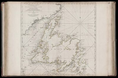
Name: A General Chart of the Island of Newfoundland with the Rocks & Soundings. Drawn from Surveys taken by James Cook and Michael Lane, Surveyors.
Barcode:
Creator:
Date Published: May 10th, 1775
Content:
Surveyor:
Publisher:
Language:
Region Depicted:
Dimensions: Map: H 54.5 x W 55.5 cm on sheet: H 55 x W 75.5 cm
Printing Process:
Printing Technique:
Permenant URL: