Collection: Smith Collection
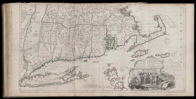
Name: A Map of the most Inhabited part of New England, containing the Provinces of Massachusetts Bay and New Hampshire, with Colonies of Connecticut and Rhode Island...
Barcode:
Creator:
Date Published: Nov 29th, 1774
Content:
Publisher:
Language:
Region Depicted:
Dimensions: Map: H 52.5 x W 98 cm on sheet: H 54.5 x W 107.5 cm
Printing Process:
Printing Technique:
Permenant URL: