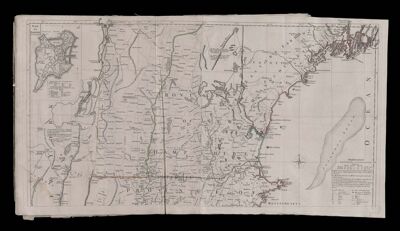
A Map of the most inhabited part of New England containing the Provinces of Massachusetts Bay and New Hampshire with the Colonies of Conecticut [sic] and Rhode Island Divided into Counties and Townships. The wole [sic] composed from the Actual Surveys and its Situation adjusted by Astronomical Observations [Part 1]
Collection: Smith Collection
Name: A Map of the most inhabited part of New England containing the Provinces of Massachusetts Bay and New Hampshire with the Colonies of Conecticut [sic] and Rhode Island Divided into Counties and Townships. The wole [sic] composed from the Actual Surveys and its Situation adjusted by Astronomical Observations [Part 1]
Barcode: 4347
Creator: Jefferys, Thomas, 1710-1771
Date Created: 1777
Date Published: 1777
Publisher: Le Rouge, Georges-Louis
Language: English
Region Depicted: MaineMassachusettsNew EnglandNew HampshireNew York (State)Vermont
Permenant URL: https://oshermaps.org/map/4347.0029