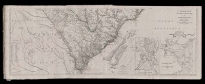
An accurate map of North and South Carolina with their Indian Frontiers Shewing in a distinct manner all the Mountains Rivers Swamps Marshes Bays Creeks Harbours Sandbanks and Soundings on the Counts; with the Roads and Indian Paths; as well as The Boundry or Provincial Lines, The Several Townships and other divisions of the Land in Both the Provinces; the whole from actual Surveys [Part 2] / Caroline Septentrionale at Meridionale
Collection: Smith Collection
Name: An accurate map of North and South Carolina with their Indian Frontiers Shewing in a distinct manner all the Mountains Rivers Swamps Marshes Bays Creeks Harbours Sandbanks and Soundings on the Counts; with the Roads and Indian Paths; as well as The Boundry or Provincial Lines, The Several Townships and other divisions of the Land in Both the Provinces; the whole from actual Surveys [Part 2] / Caroline Septentrionale at Meridionale
Barcode: 4347
Creator: Jefferys, Thomas, 1710-1771
Date Created: 1777
Date Published: 1777
Publisher: Le Rouge, Georges-Louis
Language: EnglishFrench
Region Depicted: North CarolinaNorth CarolinaSouth CarolinaSouth Carolina
Permenant URL: https://oshermaps.org/map/4347.0050