Collection: Smith Collection
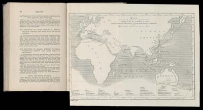
Name: Map shewing the lines of communication carried on by the steamers of the Peninsular & Oriental Steam Navigation Company, with the distances between the various ports.
Barcode:
Creator:
Date Created:
Date Published:
Language:
Dimensions: H 21 x W 28 cm
Permenant URL: