Collection: Michie Collection
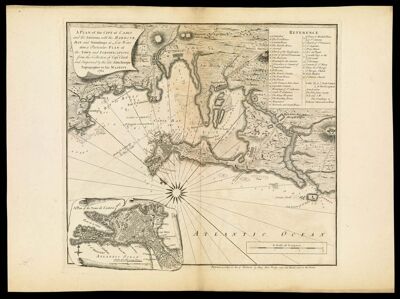
Name: A plan of the City of Cadis and the Environs, with the Harbour, Bay and Soundings at Low Water, also a Particular Plan of the Town and Fortifications from the Collection of Capt. Clark and Improved by the late John Rocque, Topographer to His Majesty. 1762
Barcode:
Creator:
Date/Date Range Produced:
Date/Date Range Published:
Language:
Dimensions: 47 x 52 cm
Printing Process:
Printing Technique:
Material Type:
Notes:
LC Call Number: G6564.C2 R6 1762
OCLC: 138106761
Accession Number: MI-1762-12
Permenant URL: