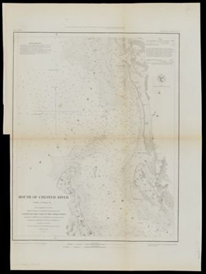
Mouth of Chester River (Harbor of Refuge No.) From a Trigonometrical Survey under the direction of A. D. Bache Superintendent of the Survey of the Coast of the United States, Triangulation by J. Ferguson and K. E. Johnston Capt. Topl. Engrs. Assistants, Topography by H.L. Whiting. R. D. Cutts and J. C. Neilson Assts., Hypography by the party under the command of W. P. Mc. Arthur Lieutenant U.S. Navy
Collection: Morin Collection
Name: Mouth of Chester River (Harbor of Refuge No.) From a Trigonometrical Survey under the direction of A. D. Bache Superintendent of the Survey of the Coast of the United States, Triangulation by J. Ferguson and K. E. Johnston Capt. Topl. Engrs. Assistants, Topography by H.L. Whiting. R. D. Cutts and J. C. Neilson Assts., Hypography by the party under the command of W. P. Mc. Arthur Lieutenant U.S. Navy
Barcode: 36568
Creator: Bache, A. D. (Alexander Dallas), 1806-1867McArthur, W. P.
Publishing Location: Washington D.C.
Notes: Notes above neat line: "Harbor No." "Presented under Authority of an Act of Congress of the United States of June 3d.1884 & by direction of the Treasury Department A.D. Bache Superintendent Coast Survey." "Electrotype Copy No. 2 by G. Mathiot U.S.C.S."Includes sailing directions, tide information, other text, and U.S. Coast Survey Office insignia.
Date/Date Range Produced: 1849
Date/Date Range Published: 1849
Language: English
Region Depicted: Maryland
Dimensions: 42 x 33 cm
Printing Process: Lithograph
Printing Technique: Planar Surface
Material Type: Paper
LC Call Number:
OCLC:
Donor: Morin
Permenant URL: https://oshermaps.org/map/36568.0001