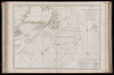
A Chart of the Banks of Newfoundland, Drawn from a Great Number of Hydrographic Surveys, Chiefly from those of Chabert, Cook and Fleurieu, Connected and Ascertained by Astronomical Observations.
Collection: Smith Collection
Name: A Chart of the Banks of Newfoundland, Drawn from a Great Number of Hydrographic Surveys, Chiefly from those of Chabert, Cook and Fleurieu, Connected and Ascertained by Astronomical Observations.
Barcode: 1986
Creator: Jefferys, Thomas, 1710-1771
Date Published: Mar 25th, 1775
Content: Graphic
Subjects: Navigation
Surveyor: Chabert, Joseph BernardCook, James, 1728-1779Fleurieu, C. P. Claret (Charles Pierre Claret), comte de, 1738-1810
Publisher: Robert Sayer and John Bennett (Firm)
Language: English
Region Depicted: Gulf of Saint Lawrence
Dimensions: Map: H on sheet: H 54.5 x W 75.5 cm
Printing Process: Engraving
Printing Technique: Copper
Permenant URL: https://oshermaps.org/map/1986.0039