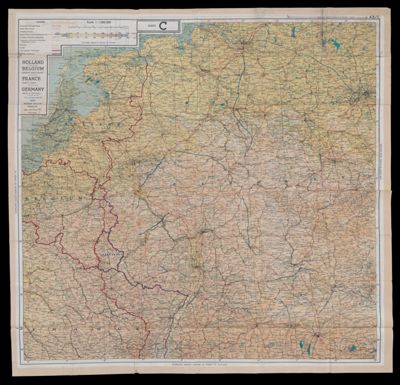
Holland, Belgium (except West Coast), France (north east), Germany (west & central); France (south east), Germany (south west), Switzerland (except south east).
Date/Date Range Produced: 1943
Language: EnglishRegion Depicted: EuropeMap Type: Route MapsDimensions: 69 x 69 cm
Physical Description: Shows cities, roads, canals, railways, international and former frontiers, and international boundaries. Map was used in World War II by servicemen to be used in case of capture or being caught behind enemy lines.
LC Call Number: G5720 1943.G6
OCLC: 26588750
Accession Number: OML-1943-96
Subjects: World War, 1939-1945Image Number: 48531.0001