Donations comprise the majority of our collections. Beyond our two founding collections, donated by the Smith and Osher families, many of our maps, globes, atlases, books, and other map-related ephemera have been generously given to us by other longt...

Moll’s “New and Correct Map of the World” Herman Moll, A New and Correct Map of the World, Laid Down According to the Newest Discoveries, and from the Most Exact Observations (London: John Bowles, Thomas Bowles, Philip Overton, and John King, 1...
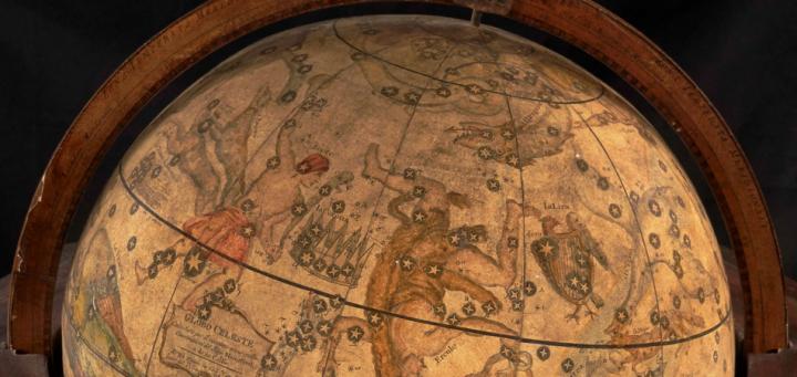
Moving forward into the future of digitizing our cultural heritage, OML’s Digital Imaging Center is engaged in an innovative project to three-dimensionally image the library’s rare globe collection, the second-largest of its kind in a U.S. public...
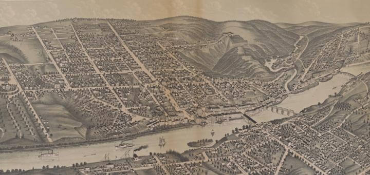
Albert Ruger, Bird’s Eye View of the City of Augusta Maine. 1878 (Madison, Wis.: J. J. Stoner, 1878).The development of lithography in the nineteenth-century created an opportunity for the development of major new markets for maps in the USA, and e...
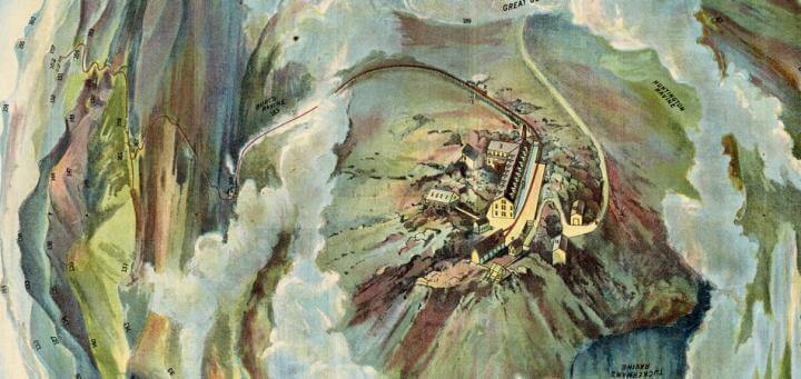
Birds-Eye View from Summit of Mt. Washington; White Mountains, New-Hampshire. In Bird’s Eye View from Mt. Washington New Hampshire.Boston: Passenger Department, Boston & Maine Railroad, ca. 1905Like a “platform to New England,” the summit o...
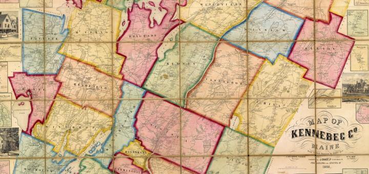
Map of Kennebec Co. Maine From actual Surveys by Baker & Co. | J. Southwick, S. Baker Surveyors | Wm. R. Shaw Ast. Publishr. | Published by J. Chace Jr. 17 & 19 Minor St. Philadelphia and Augusta, Me. 1856It might be argued that nineteenth-ce...

Washington County, Maine: 2,528 Sq. Miles of Vacation Delights (Camden, Me.: Camden Herald Pub. Co. for the Washington County Chamber of Commerce, ca. 1960)According to the Washington County Chamber of Commerce, Maine’s most eastern towns, points o...
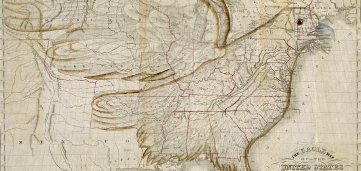
Joseph Churchman, The Eagle Map of the United States, engraved by Isaac W. Moore and copyrighted in 1832, from Churchman's Rudiments of National Knowledge, Presented to the Youth of the United States, and to Enquiring Foreigners (Philadelphia: E. L. ...

North America is a 19cm x 25cm copper-engraved map on hand-laid paper. It depicts the North American continent, including Central America and the Caribbean. While it contains the usual lines of latitude and longitude, the names of chief towns a...
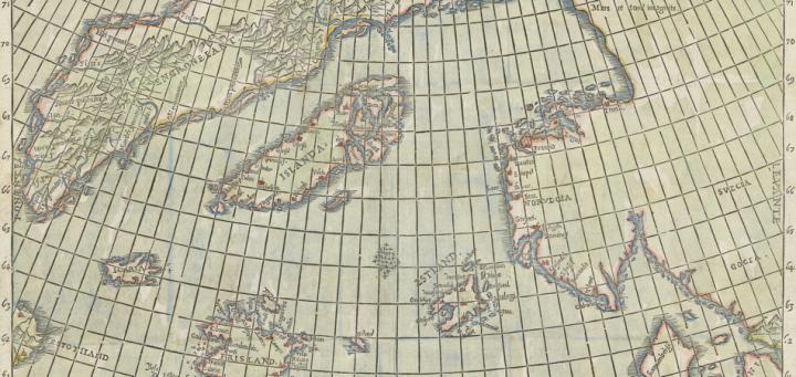
Nicolo Zeno’s map of Northern Europe was published in the Italian city-state of Venice in 1558. He wrote that he had discovered the map within his family’s archive, amongst a stash of letters, all rotten from age, created by two of his ancestors....