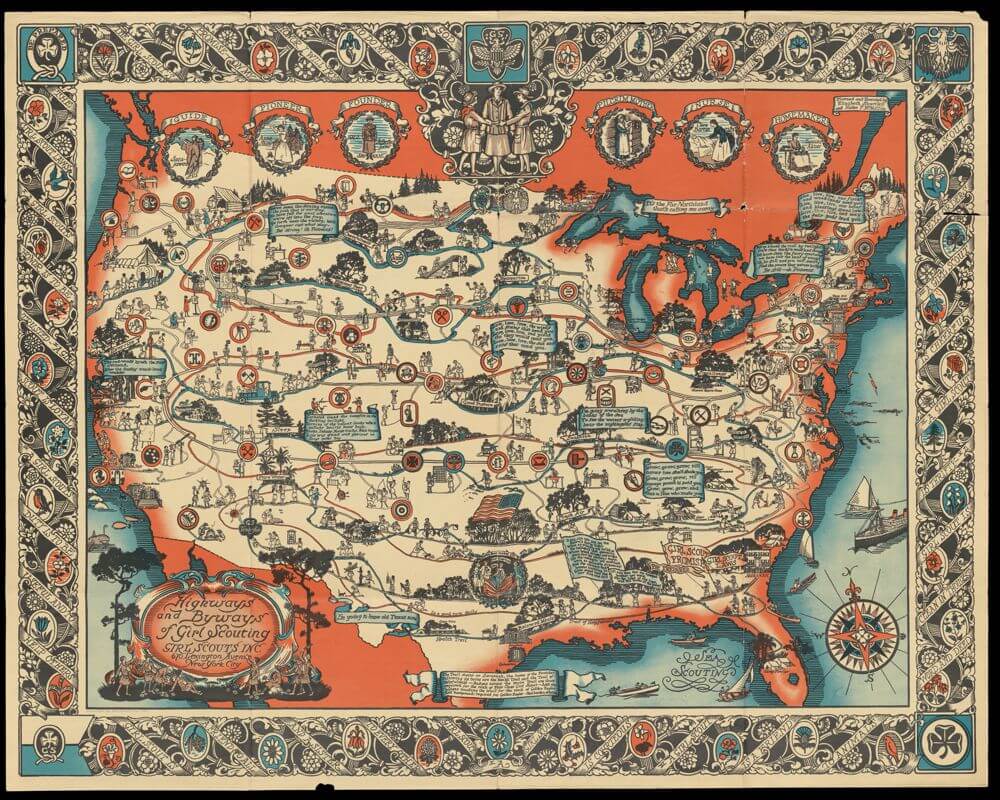
Elizabeth Shurtleff and Helen McMillin, Highways and Byways of Girl Scouting, 1927. Caroline Gerber, from Cousins Island, Maine, graduated from Yarmouth High School in June of 2025. She completed a research internship at the Osher Map Library and Sm...

By Evan Boxer-Cook, 2025 Summer intern at the Osher Map Library. Evan is a student of Classical & Medieval Studies at Bates College, with a career focus on the history of science and the study of scientific instruments. At the OML, Evan’s re...
By Jessica Hovey, Collections Manager at the Osher Map Library. The end of summer is in sight, and with it comes the inevitable reflection of "Where did the time go…and what did I do with it?" Managing the collections at OML is a year-round gig,...
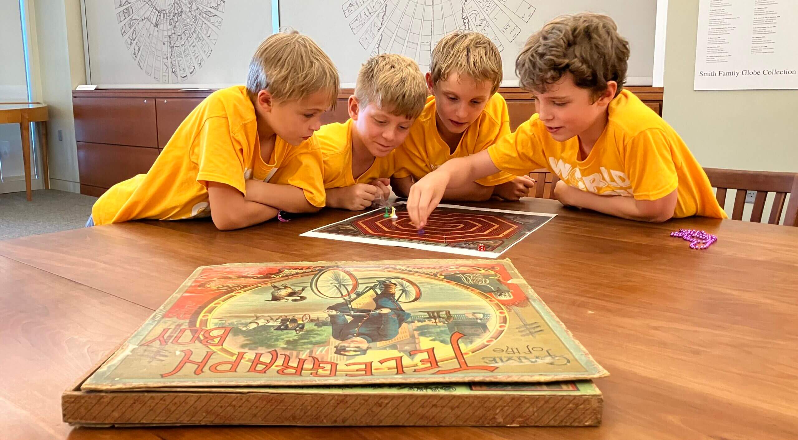
It was a landmark summer for OML's education team for many reasons, not the least of which was the launch of our Worldbuilders Summer Camp! Fifteen amazing campers joined us for a week in early August, and we couldn't have asked for a better group of...
By Krystal Pugh, 2024 Spring Intern at the Osher Map Library As I began my internship at the Osher Map Library and Smith Center for Cartographic Education (OML), I was excited to gain experience in the field of public history, but wasn’t sure wh...
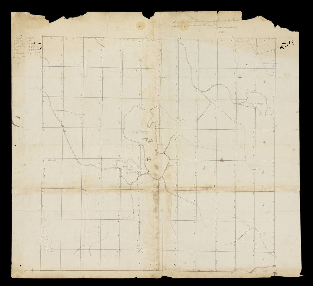
By Roberta Ransley-Matteau, Cartographic Cataloger at the Osher Map Library and Smith Center for Cartographic Education “Long and attentive inquiry and observation had convinced the writer, that the real value and character of the ex...
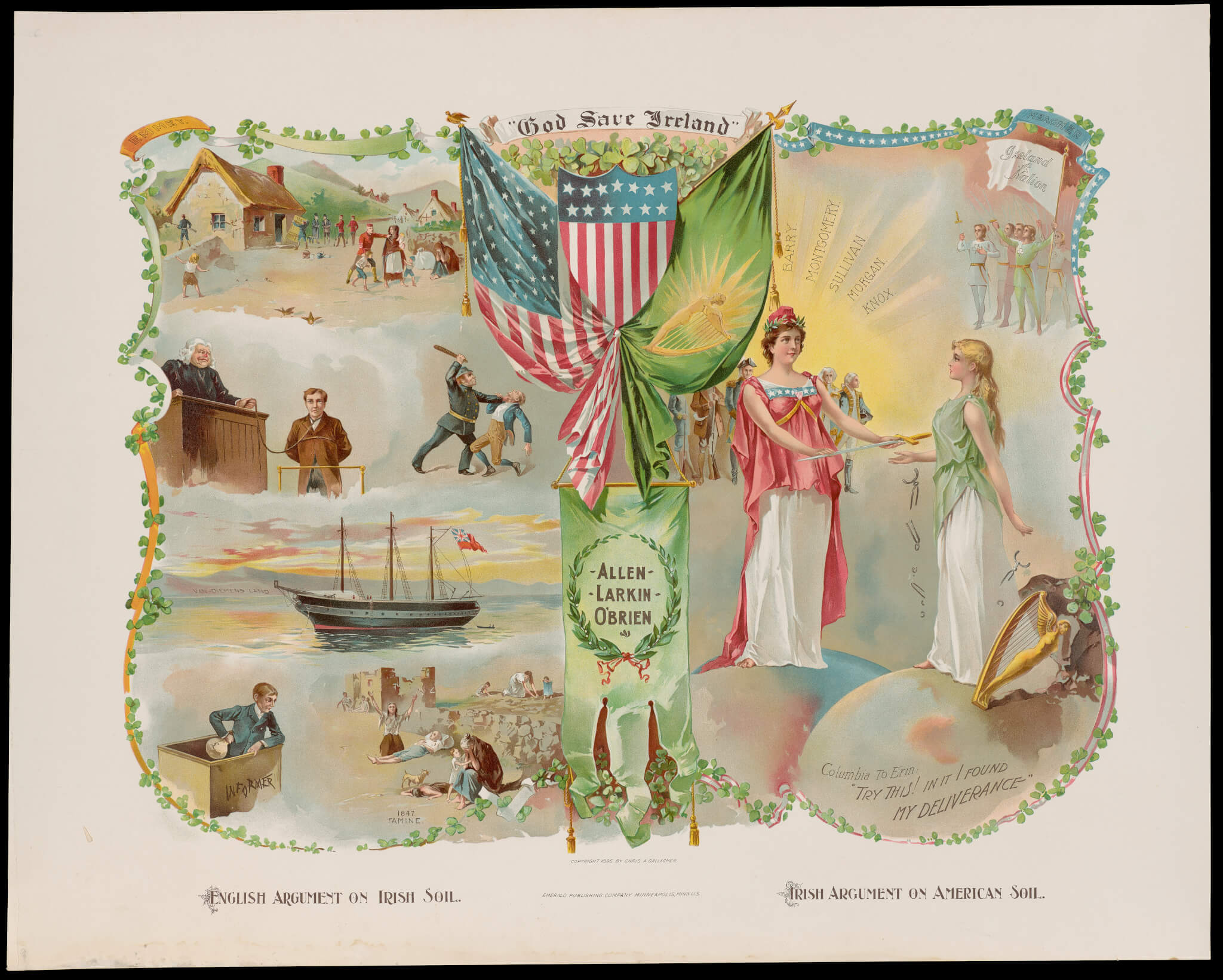
Chris. A. Gallagher, “God Save Ireland,” Minneapolis: Emerald Publishing Company, 1895. Osher Map Library Collection, University of Southern Maine. Gina Marie Guadagnino, MFA, MA, is Chief of Staff and Executive Director of Public Affairs in the...
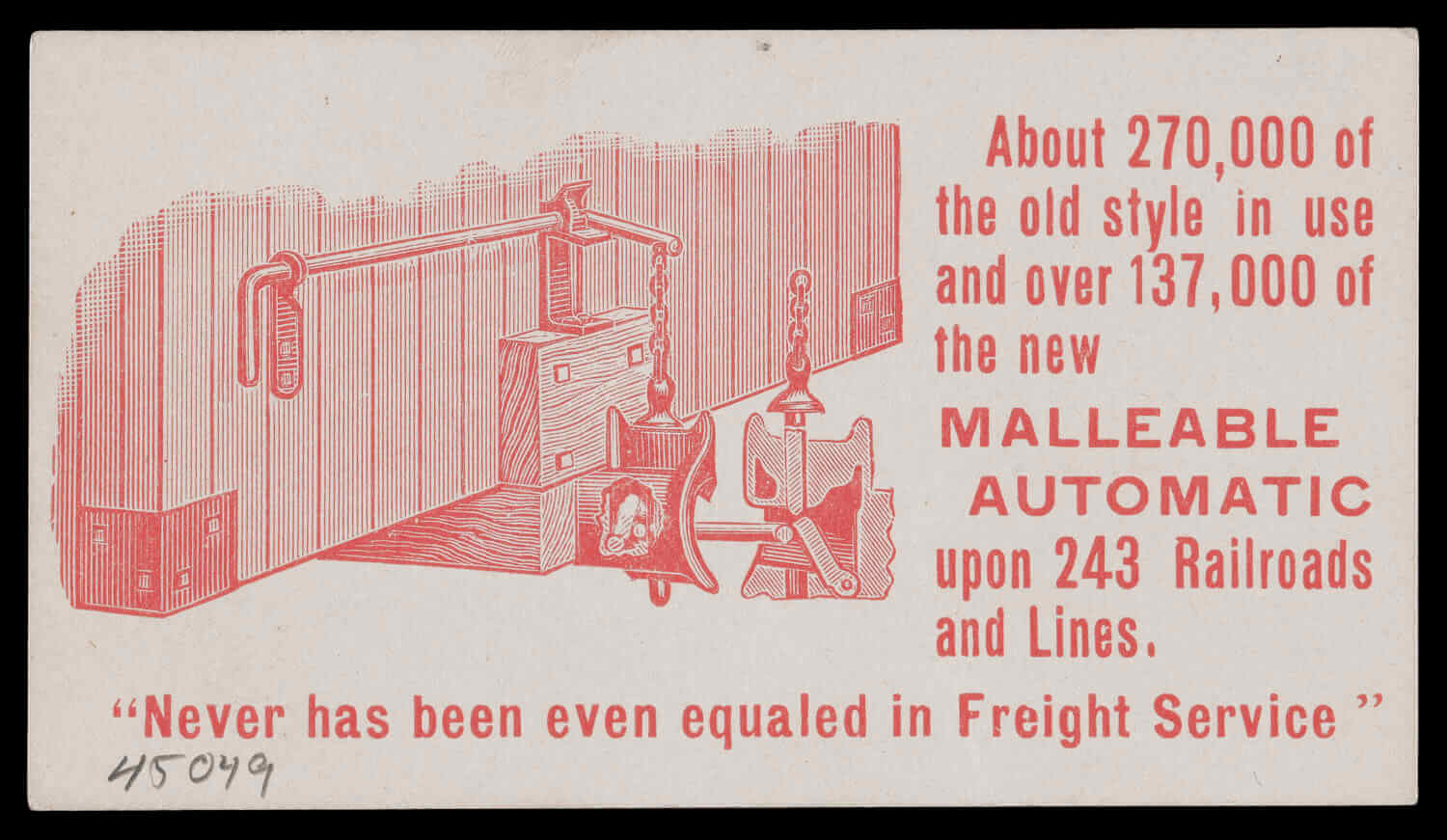
Safford Automatic Draw Bar Co. Business Card [front], 1893 Garrett Jones is a senior History major at the University of Southern Maine; he interned at the Osher Map Library and Smith Center for Cartographic Education during the spring 2023 semest...
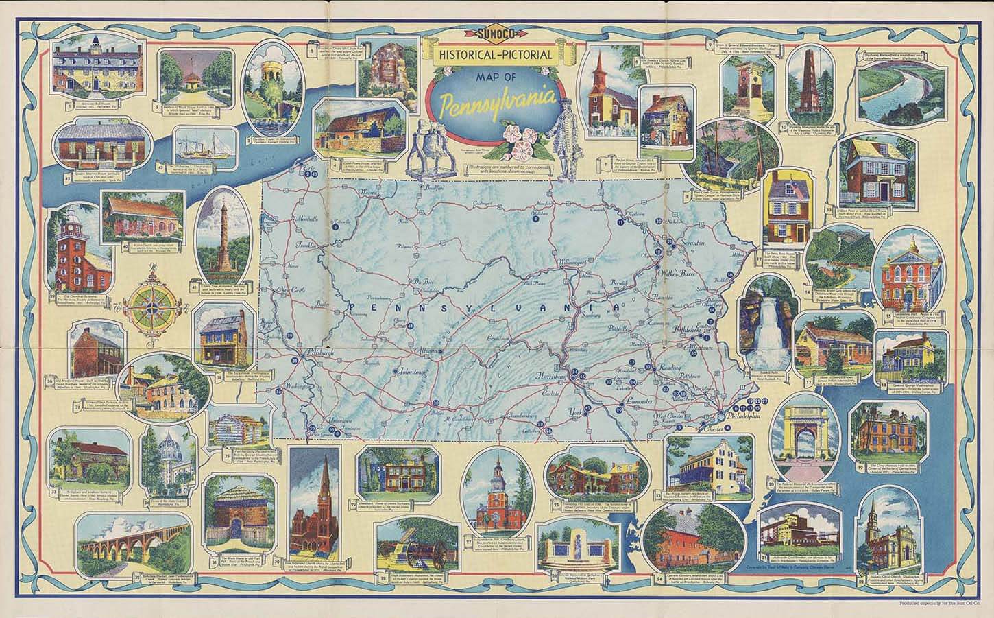
Detail: "Historical-Pictorial Map of Pennsylvania" from "Pennsylvania : Sunoco road map and historical scenic guide," 1948 If you have ever visited us in person, it's likely that you've met Bob Spencer in the Reading Room. He has been with Os...
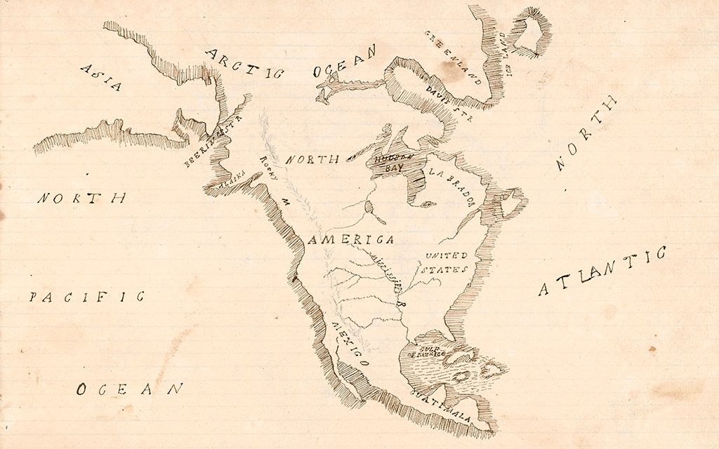
"Sarah R. Allen, Map of North America, from "Manuscript Atlas of the World", ca. 1830. Who Made These Maps? Archival Recovery and a Manuscript Atlas of the World, ca. 1830 Louie Miller is the Osher Map Library and Smith Center for Cartographic...