Showing 241-250 of 109816 results

Sort By:

Map of the Field Operations of the Army of Virginia during the months of July and August 1862
Date/Date Range Produced: 1866
Language:
Region Depicted:
Map Type:
Dimensions: 36 x 42
LC Call Number: G3881 .S5 1862
OCLC: 47709535
Accession Number: OML-1866-9
Image Number:


Map of Liberia. Compiled, from data on file in the office of the American Colonization Society, under the direction of the Revd. W. McLain, Secy. by R. Coyle
Creator:
Date/Date Range Produced: 1845
Language:
Region Depicted:
Dimensions: 43 x 61
Printing Process:
Material Type:
LC Call Number: G8880 .C6 1845
OCLC: 86222387
Accession Number: OML-1845-17
Image Number:


Salzburg : city and province, Salzkammergut Lakes, Berchtesgaden : with a plan of the city, 60 illustrations
Publisher:
Date Produced: 1965
Language:
Dimensions: Height: 18
LC Call Number: DB879.S18 S35 1965
OCLC: 794523552
Accession Number: AUL-1965-87
Donor:
Image Number:


Map of Liberia compiled from the best authorities For the Report of Rev. R.R. Gurley on the Condition of Liberia
Creator:
Date/Date Range Produced: 1850
Language:
Region Depicted:
Dimensions: 43 x 61 cm
Printing Process:
Material Type:
LC Call Number: G8880 .G8 1850
OCLC: 86222390
Accession Number: OML-1850-20
Image Number:


Guide-Book to France for Americans
Author:
Publisher:
Date Produced: 1925
Language:
Dimensions: Height: 16
LC Call Number: DC16 .N57 1925
OCLC: 9530999
Accession Number: AUL-1925-97
Donor:
Image Number:


Walling & Gray's Map of Compact Portions of Boston and the adjacent Cities and Towns.
Date/Date Range Produced: 1871
Language:
Region Depicted:
Dimensions: 38 x 59 cm
LC Call Number: G3764 .W3 1871
OCLC: 71276449
Accession Number: OML-1871-19
Image Number:


Pisa : practical guide of the cathedral square with 14 fotocolor, 19 black and white photographs, 5 plans
Author:
Publisher:
Date Produced: 1966
Language:
LC Call Number: DG975.P6 C3 1966
OCLC: 794523874
Accession Number: AUL-1966-59
Donor:
Image Number:


The Automobile Association Touring Map of Scotland Engraved and published by John Bartholomew & Son, Ltd
Date/Date Range Produced: 1936
Language:
Region Depicted:
Map Type:
Dimensions: 66 x 53 cm. on sheet 73 x 59 cm.
LC Call Number: G5770 .J67 1936
OCLC: 47262061
Accession Number: OML-1936-28
Image Number:


A Visit to Chantilly
Author:
Publisher:
Date Produced: 1932
Language:
LC Call Number: DC801.C42 M3 1932
OCLC: 789282101
Accession Number: AUL-1932-67
Donor:
Donation Date: Jan 1st, 2012
Image Number:


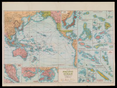
Map of Pacific Ocean Mercators Projection compiled by H.E.C. Robinson P.T.Y.L.T.D
Date/Date Range Produced: 1945
Language:
Region Depicted:
Dimensions: 52 x 65 cm. on sheet 77 x 102 cm., folds to 26 x 20 cm.
LC Call Number: G9230 .H4
OCLC: 54622458
Accession Number: OML-1945-22
Image Number: