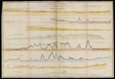
Vertical Sections, exhibiting the comparative altitudes of the principal highlands and rivers of the State of Maine.
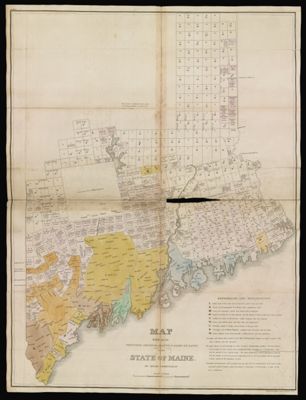
Creator: Chapin, William, 1802-1888Greenleaf, Moses, 1777-1834Date Created: 1829
Content: GraphicAlternative Title: No. 1 - Northern boundary along the highlands dividing the waters of the St. Lawrence from those of the Atlantic; No. 2. From the great northern ridge to Mars Hill, dividing the waters of Penobscot & St. John; No. 3. Comparative inclination of St. Johns, Penobscot & Kennebeck Rivers; No. 4. Inclination of the Aroostook for 110 miles from its Mouth. Odells survey; No. 5. Eastern Boundary. Bouchette's survey 100 miles and Odell & Johnsons continuation; No. 6. From the sea near Harpwell due north to the Northwestern boundary; No. 7. From Thomaston north to the northern boundary; No. 8. From Frenchman's Bay, north; No. 9. Road from Hallowell to Quebec Capt. Partridge's survey; No. 10. From the northwest boundary nearly east to the sources of the St. Croix; Plate IV
Image Number: 45936.0024