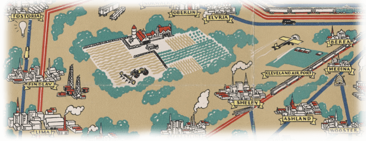
[expand title="EXHIBIT NAVIGATION"] The Golden Age of American Pictorial Maps 1. Early Maps 2. Maps of Place and Region 3. Maps to Instruct 4. Maps to Amuse 5. Maps for Industry 6. Maps for War 7. Maps for Postwar America [/expand] 19. Clevela...
[expand title="EXHIBIT NAVIGATION"] The Golden Age of American Pictorial Maps 1. Early Maps 2. Maps of Place and Region 3. Maps to Instruct 4. Maps to Amuse 5. Maps for Industry 6. Maps for War 7. Maps for Postwar America [/expand] 14. ...
[expand title="EXHIBIT NAVIGATION"] The Golden Age of American Pictorial Maps 1. Early Maps 2. Maps of Place and Region 3. Maps to Instruct 4. Maps to Amuse 5. Maps for Industry 6. Maps for War 7. Maps for Postwar America [/expand] 10. ...
[expand title="EXHIBIT NAVIGATION"] The Golden Age of American Pictorial Maps 1. Early Maps 2. Maps of Place and Region 3. Maps to Instruct 4. Maps to Amuse 5. Maps for Industry 6. Maps for War 7. Maps for Postwar America [/expand] 5. E...
[expand title="EXHIBIT NAVIGATION"] The Golden Age of American Pictorial Maps 1. Early Maps 2. Maps of Place and Region 3. Maps to Instruct 4. Maps to Amuse 5. Maps for Industry 6. Maps for War 7. Maps for Postwar America [/expand] Joan...

[expand title="EXHIBIT NAVIGATION"] To Conquer or Submit: America Views the Great War 1. Persuasive Maps 2. Propaganda Posters 3. Newsmaps 4. Military Maps 5. Wartime Atlases 6. Miscellaneous [/expand] 44. [William Hunter's journal] Willi...
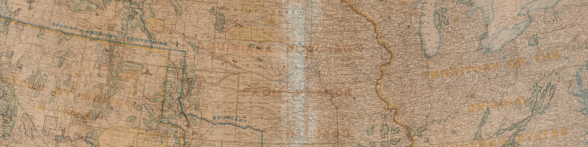
[expand title="EXHIBIT NAVIGATION"] Stately Cartography: Fifty Maps of Fifty States 1. State Maps of the Early Republic 2. Mitchell Maps 3. Asher & Adams Maps 4. Rand McNally Maps 5. National Geographic Maps 6. National Highways Associatio...
[expand title="EXHIBIT NAVIGATION"] Stately Cartography: Fifty Maps of Fifty States 1. State Maps of the Early Republic 2. Mitchell Maps 3. Asher & Adams Maps 4. Rand McNally Maps 5. National Geographic Maps 6. National Highways Associatio...
[expand title="EXHIBIT NAVIGATION"] Stately Cartography: Fifty Maps of Fifty States 1. State Maps of the Early Republic 2. Mitchell Maps 3. Asher & Adams Maps 4. Rand McNally Maps 5. National Geographic Maps 6. National Highways Associatio...
[expand title="EXHIBIT NAVIGATION"] Stately Cartography: Fifty Maps of Fifty States 1. State Maps of the Early Republic 2. Mitchell Maps 3. Asher & Adams Maps 4. Rand McNally Maps 5. National Geographic Maps 6. National Highways Associatio...