[expand title="EXHIBIT NAVIGATION"] Mapping the Classroom: Teaching Geography and History in Nineteenth and Twentieth Century New England 1. The Visual Culture of New England Classrooms 2. Schoolgirl Maps, Embroideries, and Penmanship Exercises ...
[expand title="EXHIBIT NAVIGATION"] Mapping the Classroom: Teaching Geography and History in Nineteenth and Twentieth Century New England 1. The Visual Culture of New England Classrooms 2. Schoolgirl Maps, Embroideries, and Penmanship Exercises ...
[expand title="EXHIBIT NAVIGATION"] Mapping the Classroom: Teaching Geography and History in Nineteenth and Twentieth Century New England 1. The Visual Culture of New England Classrooms 2. Schoolgirl Maps, Embroideries, and Penmanship Exercises ...
[expand title="EXHIBIT NAVIGATION"] Mapping the Classroom: Teaching Geography and History in Nineteenth and Twentieth Century New England 1. The Visual Culture of New England Classrooms 2. Schoolgirl Maps, Embroideries, and Penmanship Exercises ...
[expand title="EXHIBIT NAVIGATION"] Mapping the Classroom: Teaching Geography and History in Nineteenth and Twentieth Century New England 1. The Visual Culture of New England Classrooms 2. Schoolgirl Maps, Embroideries, and Penmanship Exercises 3. ...
[expand title="EXHIBIT NAVIGATION"] Mapping the Classroom: Teaching Geography and History in Nineteenth and Twentieth Century New England 1. The Visual Culture of New England Classrooms 2. Schoolgirl Maps, Embroideries, and Penmanship Exercises ...
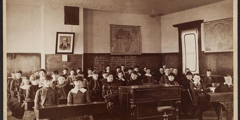
Exhibit Introduction: "Mapping the Classroom" examines the ways in which the young men and women of New England were taught the subjects of History and Geography in the nineteenth and twentieth centuries by bringing visitors into the classrooms of...

Indigenous Peoples of North America: Wars, Treaties, Reservations, Etc. https://oshermaps.org/map/710 https://oshermaps.org/map/714 https://oshermaps.org/map/712 https://oshermaps.org/map/720 https://oshermaps.org/map/492 https://oshermaps...
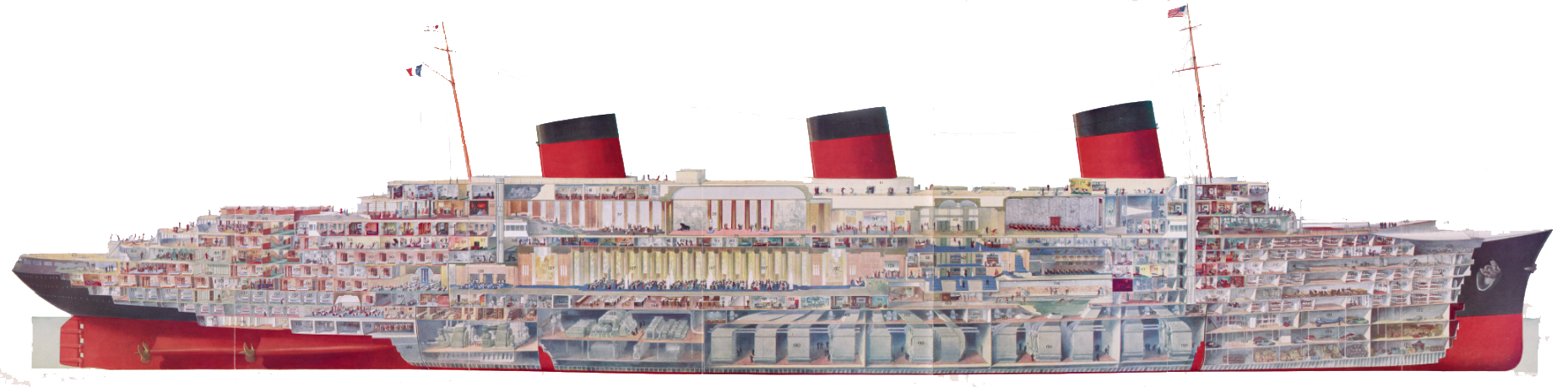
[expand title="EXHIBIT NAVIGATION"] Triumph of the Passenger Ship 1A. Norman H. Morse and the History of the Ocean Liner 1B. Ocean Liner History 1C. Growth of a Passion 2. The Evolution of the Ocean Liner 3. Steamship Advertisements 4. Steam...
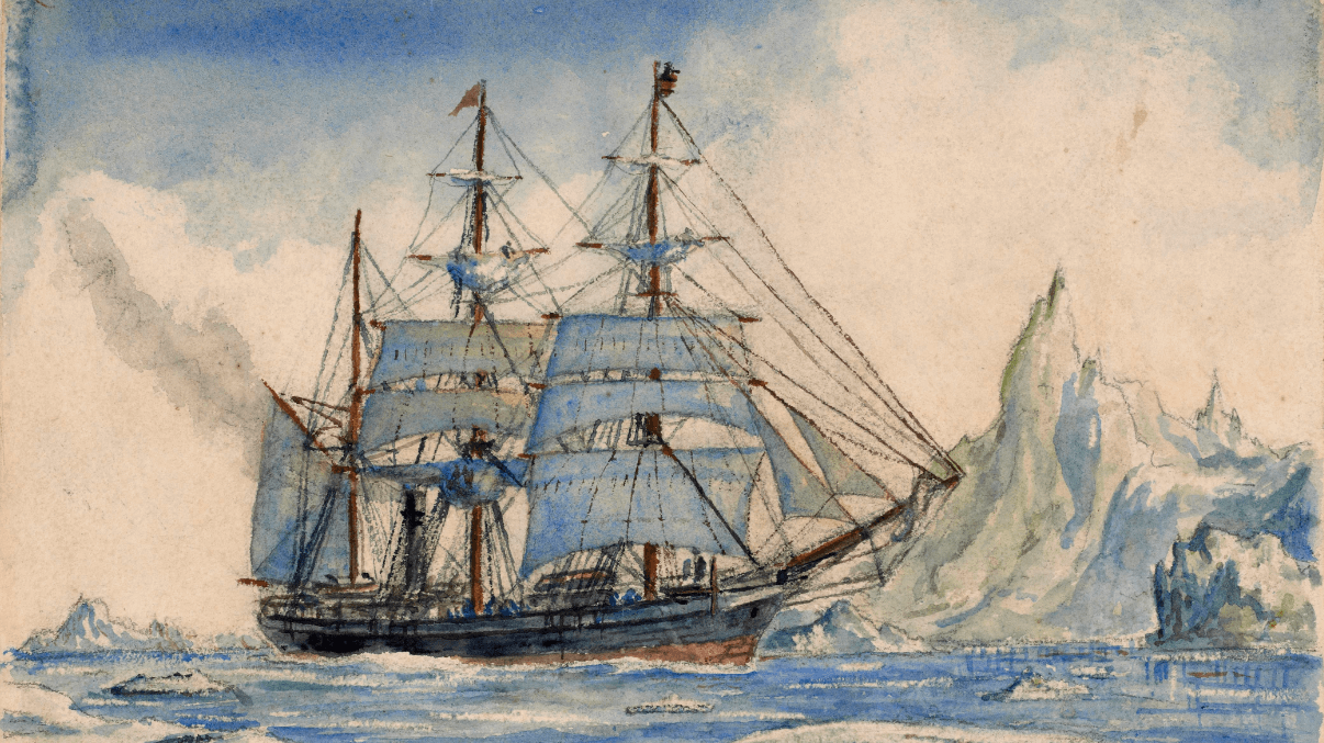
[expand title="EXHIBIT NAVIGATION"] The the Ends of the Earth... and Back 1. Imagining the Globe and its Poles 2. Elusive Passages through the Arctic 3. Nineteenth-Century Images of North Polar Exploration 4. Imagining Terra Australis 5. Earl...