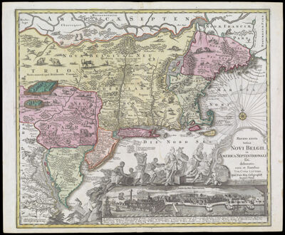
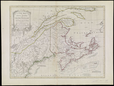
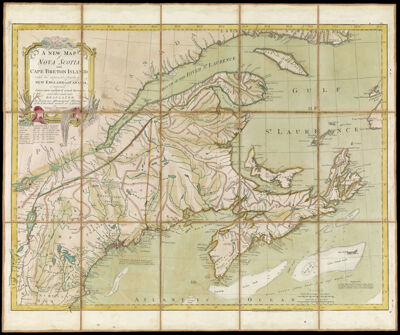
Partie de l'Amerique Septent? qui comprend La Nouvelle France ou Le Canada, Par le Sr. Robert de Vaugondy Geog? Ordinaire du Roy. Avec Privilege 1755.
Creator: Robert de Vaugondy, Gilles, 1688-1766Atlas Reference: Atlas UniverselDate/Date Range Produced: 1755
Language: FrenchRegion Depicted: CanadaMaineMassachusettsNew EnglandNew HampshireNewfoundland and LabradorNova ScotiaOntarioVermontMap Type: GeographicalPolitical mapsDimensions: H 51.2 x W 67.5 cm
Printing Process: EngravingMaterial Type: PaperHistorical Context: This hand-colored map of the Canadian Maritimes features a cartouche engraved and signed by Catherine Haussard. The design is conventional, with common symbols for North America: pine trees, a Native American canoe, and a beaver. The listing of hundreds of Native American villages in Canada provides an invaluable visual and historical record of tribal locations that would soon disappear from maps of the region.
Accession Number: OS-1755-22
Donor: OsherImage Number: 690.0001
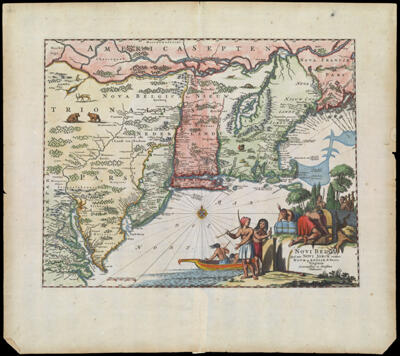
![Novi Belgii, quod nunc Novi Jorck vocatur, Novae q[ue] Angliae & Partis Virginiae Accuratissima et Novissima Delineatio](https://cdn1.historyit.com/iiif/2/5f34291499c4a6.60628694/6452abdf0d0911.21122069.jpg/full/!400,400/0/default.jpg?no_errors=1)