Showing 51-60 of 385 results

Sort By:


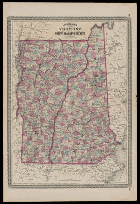
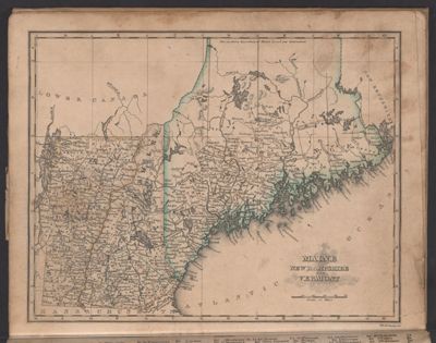
Johnson's Vermont and New Hampshire
Publisher:
Language:
Region Depicted:
Map Type:
Dimensions: 56 x 41 cm, on sheet 70 x 46 cm
LC Call Number: G3750 1867.J65
OCLC: 16100245
Accession Number: OML-1867-53
Subjects:
Image Number:


Map of the state of Vermont prepared under the direction of Public Service Commission of the state of Vermont; George F. Cram, engraver and publisher.
Publisher:
Language:
Region Depicted:
Dimensions: 107 x 65 cm
LC Call Number: G3750 1914.C7
OCLC: 893608973
Accession Number: ATH-1914-110
Donor:
Image Number:


Map of the county of Essex, Vermont
Publisher:
Language:
Region Depicted:
Dimensions: 139 x 103 cm
LC Call Number: G3753.E7 1878 F2
OCLC: 822962887
Accession Number: ATH-1878-61
Donor:
Image Number:


Maine, New Hampshire and Vermont
Content:
Region Depicted:
Image Number:


Maine, New Hampshire, and Vermont.
Content:
Language:
Region Depicted:
Image Number:


A Map of the States of New Hampshire and Vermont
Creator:
Date Created: 1809
Region Depicted:
Dimensions: H 23 x W 27 cm
Image Number:


Vermont. / Geography of Vermont.
Date Published: 1886
Content:
Publisher:
Image Number:


Vermont
Vermont
Content:
Image Number: