

Collection: Smith Collection
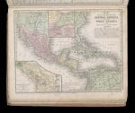
Name: Map of Mexico, Central America, and the West Indies / The isthmus of Nicaragua showing the propsed routes from the Caribbean Sea to the Pacific Ocean / The isthmus of Tehuantepec showing the propsed route from the Gulf of Mexico to the Pacific Ocean
Barcode:
Image Number:
Content:
Subjects:
Full Title: Map of Mexico, Central America, and the West Indies / The isthmus of Nicaragua showing the proposed routes from the Caribbean Sea to the Pacific Ocean / The isthmus of Tehuantepec showing the proposed route from the Gulf of Mexico to the Pacific Ocean
Region Depicted:
Permanent URL: