

Collection: Osher Collection
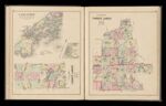
Name: Casco Bay from Broad Sound to Cape Elizabeth Light Drawn from U.S. coast survey chart / Colby's Maps of the Timber Lands of Maine No. 1. / Colby's Maps of the Timber Lands of Maine No. 2.
Barcode:
Image Number:
Creator:
Printmaker:
Date Published: 1887
Full Title: Casco Bay from Broad Sound to Cape Elizabeth Light Drawn from U.S. coast survey chart / Colby's Maps of the Timber Lands of Maine No. 1. / Colby's Maps of the Timber Lands of Maine No. 2.
Publisher:
Language:
Permanent URL: