↑ Parent: Atlas of the War Maps, Plans, Diagrams and Pictures illustrating the Great European War
Collection: Osher Collection
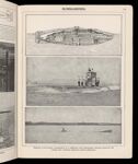
Name: Submarines
Barcode: 3907
Image Number: 3907.0083
Permanent URL: https://oshermaps.org/map/3907.0083