

↑ Parent: United States at War American War Atlas
Collection: Osher Collection
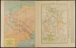
Name: The Panama Canal / The relative size of the United States and the European powers
Barcode:
Image Number:
Creator:
Date Published: 1917
Region Depicted:
Subjects:
Permanent URL: