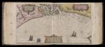
Collection: Osher Sheet Map Collection
Title: Terra Sancta, A Petro Laicstain perlustrata, et ab eius ore et schedis a Christiano Schrot in tabulum redacta., copy 2
Title Translation: The Holy Land, compiled by Peter Laicksteen, and from his words and documents made into a map by Christian Schrot
Barcode: 340
Creator: Sgrooten, Christian (approximately 1525 -1604), Laicksteen, Peter
Publisher: Plantin, Christophe (1520 -1589)
Publishing Location: Antwerp
Region Depicted: Middle East · Holy Land · Palestine · Israel
Date Produced: 1584
Date Published: 1584
Language: Dutch
Subjects: Sgrooten, Christian, approximately 1525-1603 · Laicksteen, Peter, active approximately 1556-1570 · Plantin, Christophe, approximately 1520-1589 · Middle East · Holy Land · Palestine · Israel · Bible --Geography · Maps--Early works to 1800
Map Type: Geographical, Political
Dimensions: 36 x 50 cm.
Printing Process: Engraving
Printing Technique: Copper
Material Type: Paper
Notes: This map is from the 1584 Ortelius Theatrum Orbis Terrarum printed in Antwerp by Christopher Plantin, and was the first printing of the map which appears in all editions until 1612. This is Copy 2. Copy 1 is OML-1584-6.
Brief Description: Map of the Holy Land decorated with scenes from the Bible. Oriented with North at the left.
Physical Description: 1 map: illustrated, colored
Theme: The Holy Land
Associated Cartouche: Cartouche 1, 1584, Terra Sancta, A Petro Laicstain perlustrata, et ab eius ore et schedis a Christiano Schrot in tabulum redacta., copy 2, Cartouche 2, 1584, Terra Sancta, A Petro Laicstain perlustrata, et ab eius ore et schedis a Christiano Schrot in tabulum redacta., copy 2
Associated Map Imagery: Jonah and Sea Monster, 1584, Terra Sancta, A Petro Laicstain perlustrata, et ab eius ore et schedis a Christiano Schrot in tabulum redacta., copy 2
Collection/Donor: Osher
Permanent URL: https://oshermaps.org/map/340.0001