Previous Page         Next Page

[continuation of previous map]


↑ Parent: The American atlas or, A geographical description of the whole continent of America. Wherein are delineated at large, its several regions, countries, states, and islands and chiefly the British colonies. Engraved on 48 copper-plates, by Thomas Jefferys and others

Collection: Smith Collection

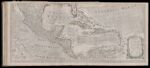
Name: [continuation of previous map]

Barcode:

Image Number:

Creator:

Date Published: Jul 2nd, 1775

Content:

Subjects:

Publisher:

Language:

Region Depicted:

Dimensions: Map: H 51 x W 116 cm on sheet: H 54.5 x W 121 cm

Printing Process:

Printing Technique:

Permanent URL: