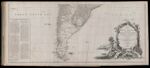
A Map of South America Containing Tierra-Firma, Guayana, New Granada, Amazonia, Brasil, Peru, Paraguay, Chaco, Tucuman, Chili and Patagonia.
↑ Parent: The American atlas or, A geographical description of the whole continent of America. Wherein are delineated at large, its several regions, countries, states, and islands and chiefly the British colonies. Engraved on 48 copper-plates, by Thomas Jefferys and others
Collection:
Smith Collection
Name: A Map of South America Containing Tierra-Firma, Guayana, New Granada, Amazonia, Brasil, Peru, Paraguay, Chaco, Tucuman, Chili and Patagonia.
Barcode: 1986
Image Number: 1986.0081
Creator: Jefferys, Thomas, 1710-1771
Date Published: Sep 20th, 1775
Content: Graphic
Subjects: Native American tribes
Surveyor: Anville, Jean Baptiste Bourguignon d', 1697-1782
Publisher: Robert Sayer and John Bennett (Firm)
Language: English
Region Depicted: ChileFalkland IslandsParaguayPatagoniaTierra del Fuego (Argentina and Chile)
Dimensions: Map: H 50 x W 118 cm on sheet: H 55 x W 123.5 cm
Printing Process: Engraving
Printing Technique: Copper
Permanent URL:
https://oshermaps.org/map/1986.0081