

Collection: Smith Collection
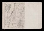
Name: A Map of the most inhabited part of New England containing the Provinces of Massachusetts Bay and New Hampshire with the Colonies of Conecticut [sic] and Rhode Island Divided into Counties and Townships. The wole [sic] composed from the Actual Surveys and its Situation adjusted by Astronomical Observations [Part 1] (folded)
Barcode:
Image Number:
Creator:
Date Created:
Date Published:
Full Title: A Map of the most inhabited part of New England containing the Provinces of Massachusetts Bay and New Hampshire with the Colonies of Conecticut [sic] and Rhode Island Divided into Counties and Townships. The wole [sic] composed from the Actual Surveys and its Situation adjusted by Astronomical Observations [Part 1] (folded)
Publisher:
Language:
Permanent URL: