Previous Page         Next Page

A Map of the most inhabited part of New England... (folded)


↑ Parent: Atlas Ameriquain Septentrional Atlas contenant les details des differentes provinces de ce vaste continent Traduit des Cartes levées par ordre du Gouvernement Britannique Par le Major Holland, Evans, Scull, Mouzon...

Collection: Smith Collection

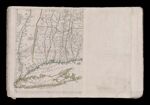
Name: A Map of the most inhabited part of New England... (folded)

Barcode:

Image Number:

Creator:

Date Created:

Date Published:

Full Title: A Map of the most inhabited part of New England... (folded)

Publisher:

Language:

Region Depicted:

Permanent URL: