Previous Page         Next Page

An accurate map of North and South Carolina with their Indian Frontiers... (folded)


↑ Parent: Atlas Ameriquain Septentrional Atlas contenant les details des differentes provinces de ce vaste continent Traduit des Cartes levées par ordre du Gouvernement Britannique Par le Major Holland, Evans, Scull, Mouzon...

Collection: Smith Collection

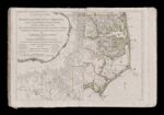
Name: An accurate map of North and South Carolina with their Indian Frontiers... (folded)

Barcode:

Image Number:

Creator:

Date Created:

Date Published:

Full Title: An accurate map of North and South Carolina with their Indian Frontiers... (folded)

Publisher:

Language:

Region Depicted:

Permanent URL: