By Roberta Ransley-Matteau, Cartographic Cataloger at the Osher Map Library and Smith Center for Cartographic Education “Long and attentive inquiry and observation had convinced the writer, that the real value and character of the ex...

AncientOrigins.net journalist Mark Miller presents a fascinating story about the boundary debate regarding the South China Sea islands: Link to Article...
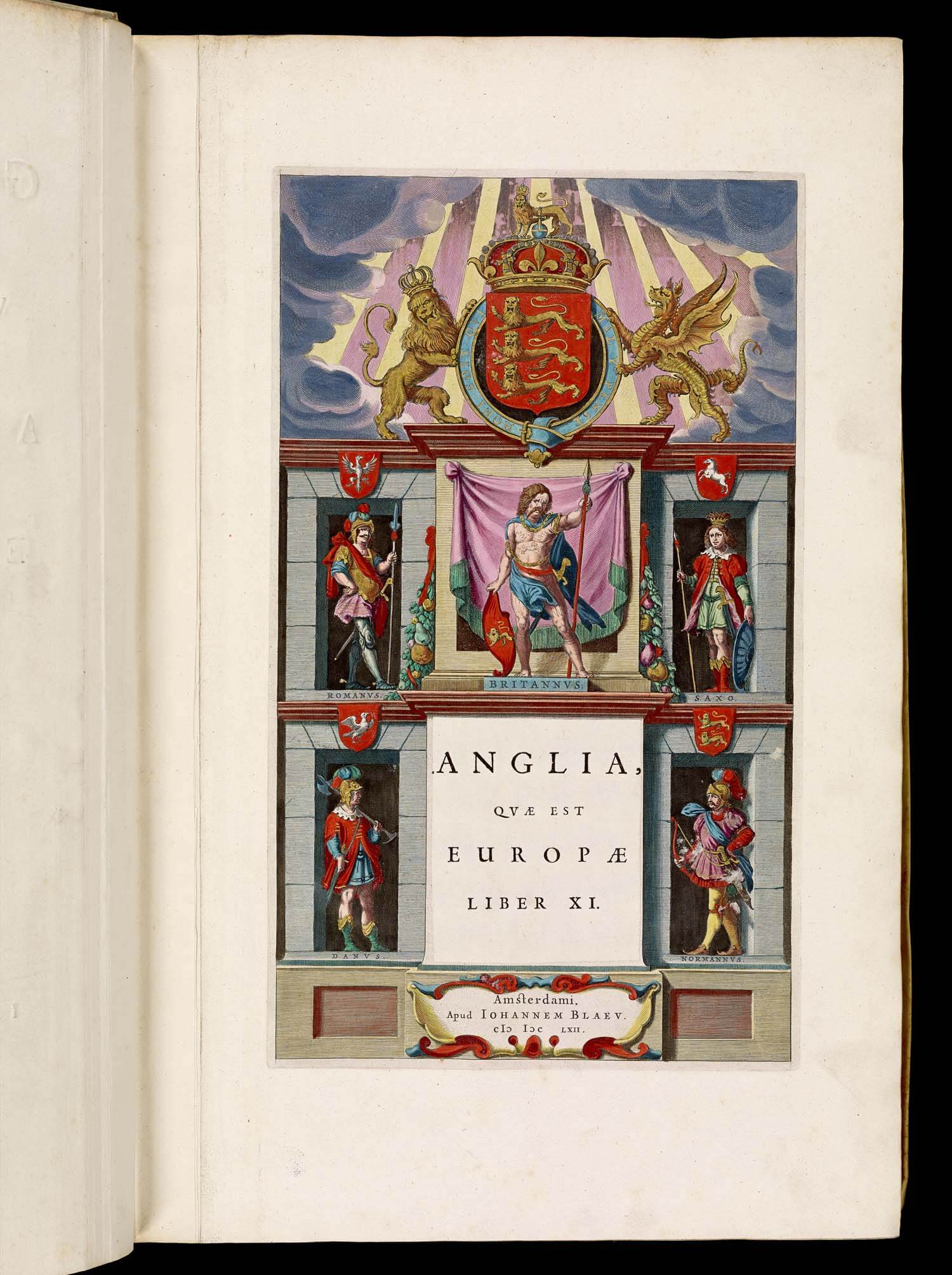
Three more volumes of Joan Blaeu’s Atlas Major, sive cosmographia have been posted to the site: volume 3, covering “Germania” [van der Krogt, 2:601[-3].3]; volume 4, covering “The Low Countries” [van der Krogt, 2:601[-3].4]; and volume 5, c...

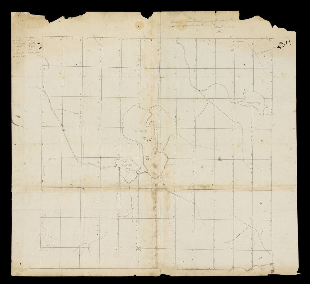
The Portsmouth Historical Society is celebrating the 400th anniversary of Capt. John Smith's sailing down the coast of what he would later call New England with an exhibition detailing the history of the mapping of the Piscataquis Region of Maine and...

Many European nations attempted New World colonies during the 17th century, but odds are that you have never heard of Scotland's attempt at imperialism. Unfortunately for the Scottish colonists, the colonial effort was placed in one of the harshest e...
The (London) Guardian had a great piece in yesterday's newspaper on the representation of Africa in early and modern maps. Give it a read!The essay, by James Wan, originally appeared in the blog Think Africa, and explores the persistent ways in ...
...for Junior Cartographers How to Enter Be age 14 or under! Use a piece of paper (Max Size: 11x17 inches) and whatever art medium you prefer (paint, crayons, markers, etc.) OR use a computer program. Create a map of an imaginary continent in e...
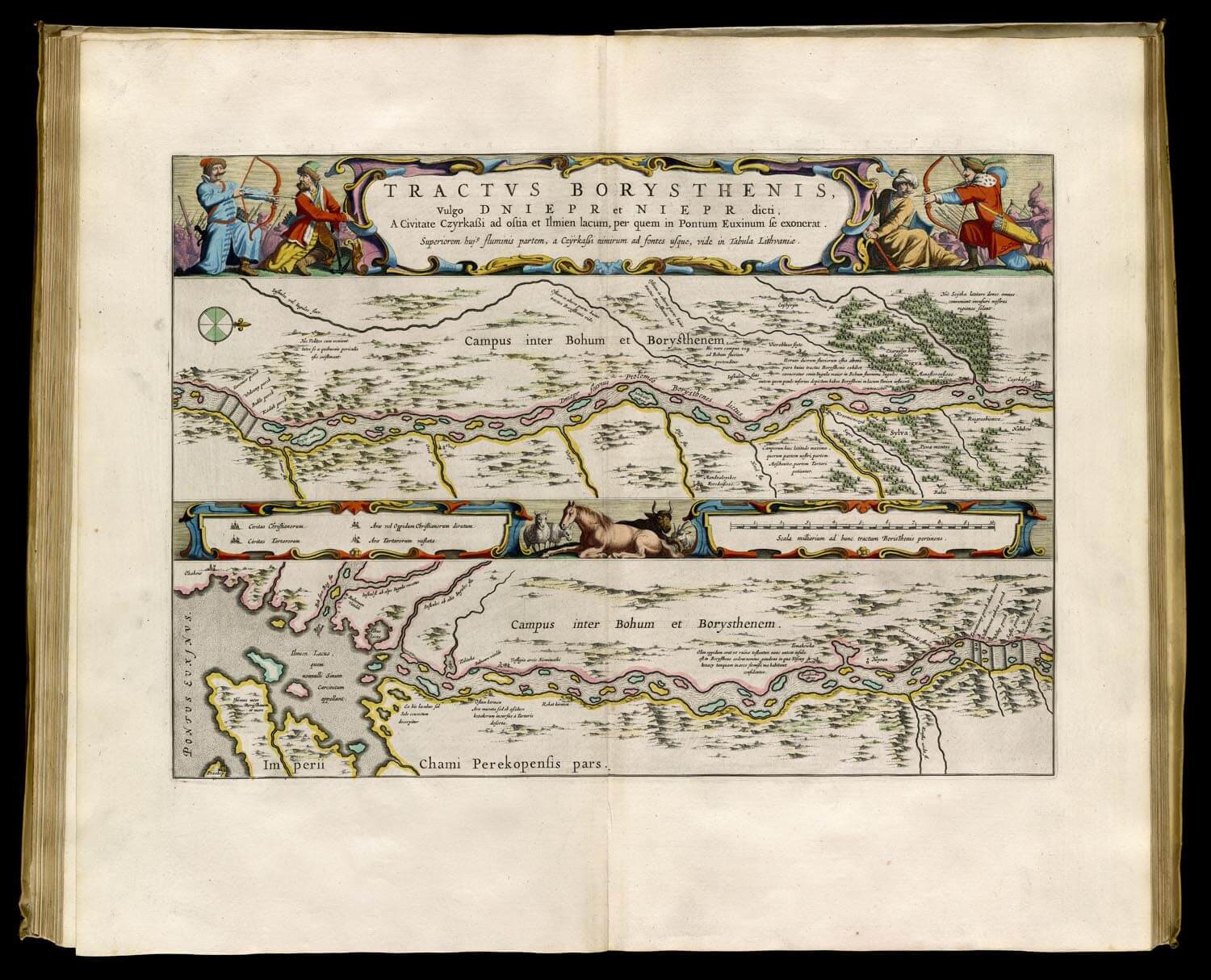
We are pleased to announce that we have posted to the site the second volume of the Atlas Major, sive cosmographia by Joan Blaeu. (See an earlier blog post about the volumes). Volume 2 covers Sweden, Russia, Poland, Southeastern Europe and Gree...
The OML exhibition, "To the Ends of the Earth . . . and back," curated by Arthur Dunkelman from materials in the Jay I. Kislak Polar Collection, is the subject of a review in the Portland Press Herald! ...
According to NPR the National Oceanic and Atmospheric Administration will cease to print the lithographic nautical charts that it has printed since the 1860's. These charts will still be available digitally from the NOAA and physically through autho...