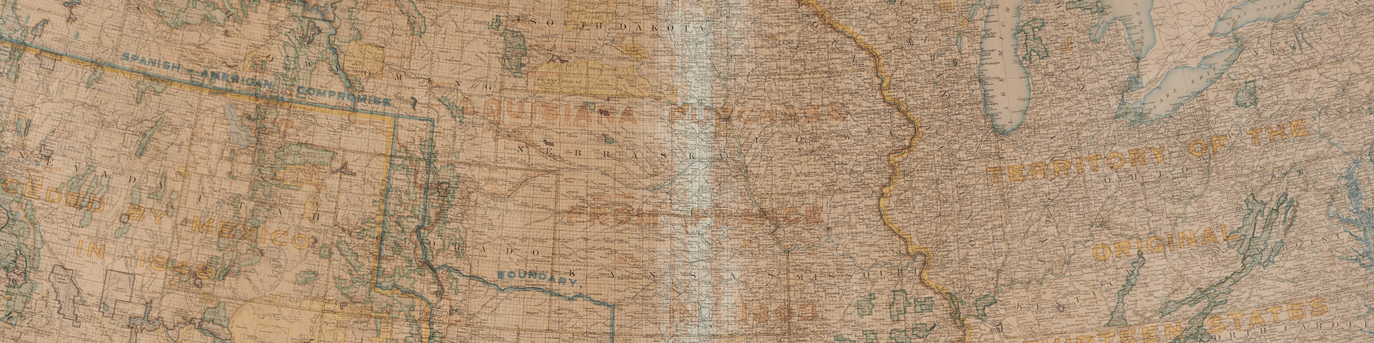
[expand title="EXHIBIT NAVIGATION"] Stately Cartography: Fifty Maps of Fifty States 1. State Maps of the Early Republic 2. Mitchell Maps 3. Asher & Adams Maps 4. Rand McNally Maps 5. National Geographic Maps 6. National Highways Associatio...
[expand title="EXHIBIT NAVIGATION"] Stately Cartography: Fifty Maps of Fifty States 1. State Maps of the Early Republic 2. Mitchell Maps 3. Asher & Adams Maps 4. Rand McNally Maps 5. National Geographic Maps 6. National Highways Associatio...
[expand title="EXHIBIT NAVIGATION"] Stately Cartography: Fifty Maps of Fifty States 1. State Maps of the Early Republic 2. Mitchell Maps 3. Asher & Adams Maps 4. Rand McNally Maps 5. National Geographic Maps 6. National Highways Associatio...
[expand title="EXHIBIT NAVIGATION"] Stately Cartography: Fifty Maps of Fifty States 1. State Maps of the Early Republic 2. Mitchell Maps 3. Asher & Adams Maps 4. Rand McNally Maps 5. National Geographic Maps 6. National Highways Associat...
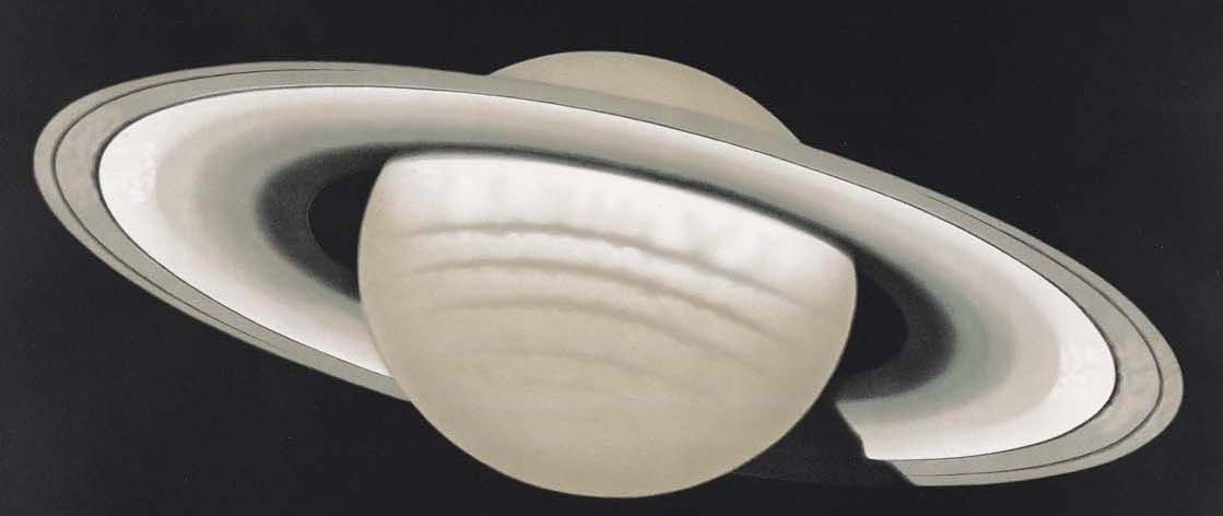
[expand title="EXHIBIT NAVIGATION"] Art of the Spheres 1. Works of Scientific Investigation 2. Popular and Pedagogic Works [/expand] Maps and diagrams are effective in explaining the Cosmos. They were prominent in the public lectures on as...
[expand title="EXHIBIT NAVIGATION"] Art of the Spheres 1. Works of Scientific Investigation 2. Popular and Pedagogic Works [/expand] The French-born artist and lithographer Étienne Léopold Trouvelot (1827–1895) was also an amateur astron...

Items 46 through 49 These images from the Illustrated London News depict the harsh conditions endured by the various expeditions sent to rescue Captain Sir John Franklin between 1848 and 1878. Captain Franklin departed from England for the Arc...
In 1906 Norwegian Roald Amundsen became the first to navigate the Northwest Passage entirely by ship. Amundsen used a small crew of six men and a 45-ton herring boat, the Gjøa, to deftly navigate the narrow channels of the passage. During thei...
Upon Joseph Nicholas De L'Isle's return to Paris in 1747, he published the Carte Des Nouvelles Découvertes Au Nord de la Mer de Sud . . . 1750, (Item 19) The French cartographic community was gripped with an intense period of scientific inquiry into...
...