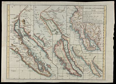
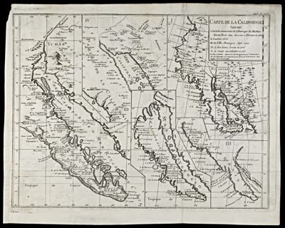
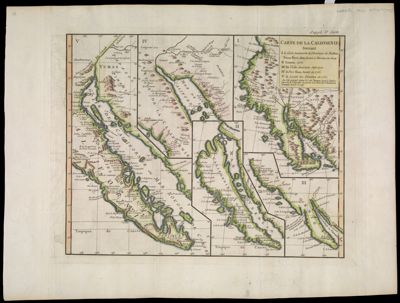
Carte de la CalifornieDate/Date Range Produced: 1774 Language:French Region Depicted:California Dimensions: 74 x 78 cm Printing Process:Engraving Material Type:Paper Accession Number: OML-1774-10 Donation Date: May 4th, 2009
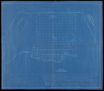
Town of LivermoreDate/Date Range Produced: 1942 Language:English Region Depicted:Livermore, Maine Dimensions: 67 X 77 cm Accession Number: OML-1942-108 Donation Date: Aug 15th, 2012

![Map of New England and part of New York [State] : Quebec, Northern Maine, and Maritime Provinces](https://cdn1.historyit.com/iiif/2/5f34291499c4a6.60628694/673606748351f4.55011094.jpg/full/!400,400/0/default.jpg?no_errors=1)