Osher Map Library Sheet Map Collection
4,666 results
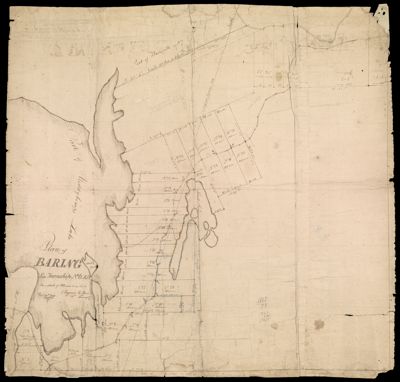
[Manuscript key map of Washington County, showing towns of Alexander, Baileyville, Cooper, Baring, Calais, Charlotte, Robbinston, Dennysville, Perry]
Creator: Jones, B. R.Date/Date Range Produced: 1830
Language: EnglishRegion Depicted: Washington County, MaineDimensions: 44 X 57 cm
Printing Technique: ManuscriptMaterial Type: PaperAccession Number: OML-1830-28
Donation Date: Apr 17th, 2001
![]()

![[property map of town of Cooper, Maine]](https://cdn1.historyit.com/iiif/2/5f34291499c4a6.60628694/671a43e0c417b3.21583579.jpg/full/!400,400/0/default.jpg?no_errors=1)
![[Manuscript key map of Washington County, showing towns of Alexander, Baileyville, Cooper, Baring, Calais, Charlotte, Robbinston, Dennysville, Perry]](https://cdn1.historyit.com/iiif/2/5f34291499c4a6.60628694/671a44776d4a80.88918413.jpg/full/!400,400/0/default.jpg?no_errors=1)