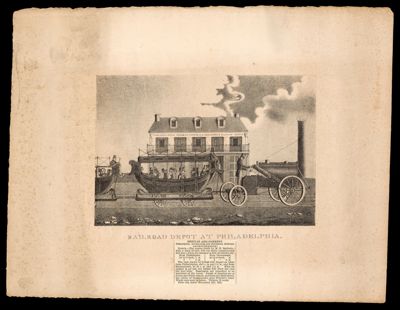
Railroad Depot at Philadelphia.
Date/Date Range Produced: 1832
Language: EnglishRegion Depicted: PhiladelphiaDimensions: 28 x 36 cm
Historical Context: The Philadelphia Germantown & Norristown Railway, incorporated in 1831, began service to Germantown in 1832 and to Norristown in 1834. The Philadelphia & Reading Railroad leased the company in 1870.
Accession Number: OML-1832-29