Osher Map Library Sheet Map Collection
4,670 results
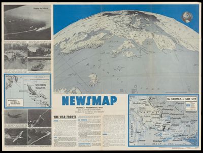
Newsmap, vol. 2, no. 29, Monday, Nov. 8, 1943 / This is Ann . . . she drinks blood!
Creator: Harrison, Richard EdesSeuss, Dr.Publisher: Washington D.C. Army Orientation Course,Language: EnglishDimensions: 89 x 120 cm
OCLC: 11013660
Accession Number: OML-1943-136
See Also: Newsmap, vol. 2, no. 1, Monday, April 26, 1943 / Dig . . . or Die! Fox Holes!Newsmap, vol. 2, no. 11, Monday, July 5, 1943 / Abandon ship!Newsmap, vol. 2, no. 23, Monday, Sept. 27, 1943 / Progress of the war of interest to every American fighting manNewsmap, vol. 2, no. 26, Monday, Oct. 18, 1943 / Target TokyoNewsmap, vol. 2, no. 27, Monday, Oct. 25, 1943 / Target BerlinNewsmap, vol. 2, no. 29, Monday, Nov. 8, 1943 / This is Ann . . . she drinks blood!Newsmap, vol. 2, no. 3, Monday, May 10, 1943 / You may be eligible for the Army Specialized Training ProgramNewsmap, vol. 2, no. 5, Monday, Sept. 14, 1942 / The not-so-soft undersideNewsmap, vol. 3, no. 15F, Monday, July 31, 1944Newsmap, vol. I, no. 21, Monday, Sept. 14, 1942 / Maps are not true for all purposesNewsmap, vol. I, no. 33, Monday, Dec. 7, 1942 / The battleground of North AfricaSubjects: World War, 1939-1945
![]()
