Patna guide mapPublisher:Survey of India Date/Date Range Produced: 1984 Dimensions: 56 x 95 cm OCLC: 21334951 Accession Number: OML-1984-143
Dehra Dūn guide mapPublisher:Survey of India Date/Date Range Produced: 1982 Dimensions: 85 x 93 cm OCLC: 41920155 Accession Number: OML-1982-116
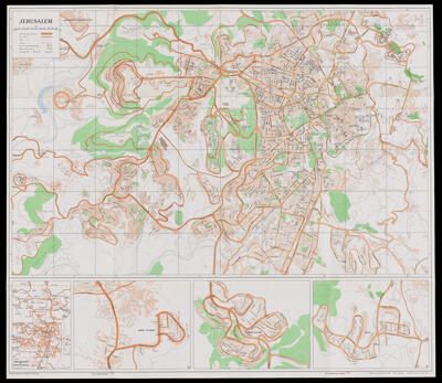
JerusalemPublisher:Survey of Israel Date/Date Range Produced: 1991 Language:English Region Depicted:Israel Map Type:Road maps Dimensions: 64 x 73 cm OCLC: 1059232941 Accession Number: OML-1991-125 Subjects:Roads