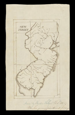
New JerseyCreator:Hillyer, Theodore Date/Date Range Produced: 1810 Language:English Region Depicted:New Jersey Dimensions: 14 x 8 cm on sheet 20 x 12 cm Printing Technique:Manuscript LC Call Number: G3810 1810. H5 OCLC: 1374212936 Accession Number: OML-1810-20
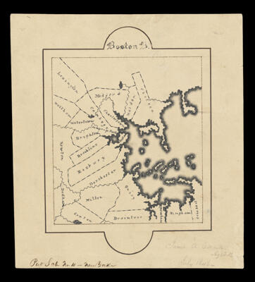
Boston B.Creator:Connor, James A. Date/Date Range Produced: 1846 Language:English Region Depicted:Boston, Massachusetts Dimensions: 10 x 9 cm on sheet 15 x 14 cm Printing Technique:Manuscript LC Call Number: G3764.B6 1846 C6 OCLC: 1374221115 Accession Number: OML-1846-73
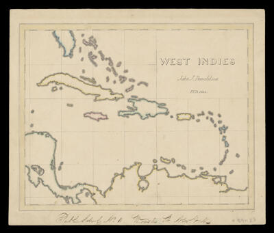
West IndiesCreator:Donaldson, John J. Date/Date Range Produced: 1844 Language:English Region Depicted:West Indies Dimensions: 20 x 25 cm on sheet 23 x 28 cm Printing Technique:Manuscript LC Call Number: G4900 1844.D6 OCLC: 1374211969 Accession Number: OML-1844-57