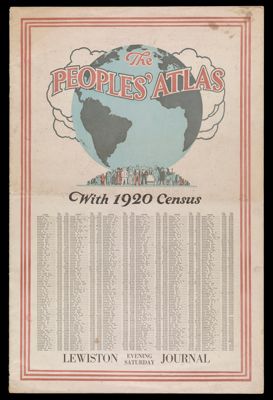
Osher Atlas Collection

838 results

Theatrum Orbis Terrarum
Author:
Date Produced: 1570
Language:
Dimensions: H 43 x W 29 cm
LC Call Number: G1006.O7 1570
OCLC: 927113404
Accession Number: OS-1570-1
Donor:
Theatrum Orbis Terrarum

Atlas Accompanying Greenleaf's Map and Statistical Survey of Maine
Author:
Date Produced: 1829
Language:
Dimensions: 34 cm
Physical Description: 1 atlas: 7 folded maps, illustrated
LC Call Number: G1215 .B5 1829
OCLC: 52568261
Accession Number: OS-1829-3
Donor:
Atlas Accompanying Greenleaf's Map and Statistical Survey of Maine

A New and Improved School Atlas to accompany The Practical System of Modern Geography
Author:
Publisher:
Date Published: 1837
Language:
Dimensions: H 29 x W 24.5 cm
Physical Description: 1 atlas (18 unnumbered leaves): illustrations, hand colored maps
LC Call Number: G1019 .O46 1837
OCLC: 40247592
Accession Number: OS-1837-1
Donor:
A New and Improved School Atlas to accompany The Practical System of Modern Geography

Mitchell's New General Atlas : containing maps of the various countries of the world, plans of the cities, etc. : embraced in forty-seven quarto maps, forming a series of seventy-six maps and plans, together with valuable statistical tables
Author:
Date Produced: 1860
Language:
Dimensions: Height: 41
Physical Description: 1 atlas: [75, 26 pages], colored maps
LC Call Number: G1019 .M5 1860
OCLC: 55520570
Accession Number: OS-1860-3
Donor:
Mitchell's New General Atlas : containing maps of the various countries of the world, plans of the cities, etc. : embraced in forty-seven quarto maps, forming a series of seventy-six maps and plans, together with valuable statistical tables

[Cassini map of France, c. 1760]
Author:
Language:
Physical Description: Container for 6 maps of France: Basle, Pad de Calais, Dunkerke, St. Omer, Cambray, Lille
[Cassini map of France, c. 1760]

[Cassini map of France, c. 1770]
Author:
Date Produced: 1770
Language:
Accession Number: OS-1770-5
[Cassini map of France, c. 1770]

Atlas of Washington County, Maine compiled, drawn, and published from official plans and actual surveys by George N. Colby & Co., assisted by H.E. Halfpenny [and others]
Publisher:
Date Produced: 1881
Language:
Dimensions: Cover: H 42 x W 36.5 cm. Pages: H 41.5 x W 68 cm
Physical Description: 1 atlas: 67 pages, colored maps
LC Call Number: G 1218 .W4 C6 1881
OCLC: 568083
Accession Number: OS-1881-9
Donor:
Atlas of Washington County, Maine compiled, drawn, and published from official plans and actual surveys by George N. Colby & Co., assisted by H.E. Halfpenny [and others]