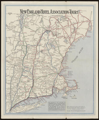
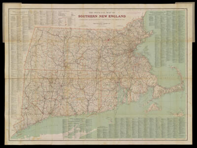
New England Hotel Association ToursDate/Date Range Produced: 1917 Language:English Dimensions: 42 cm. x 34 cm. on sheet 46 cm. x 38 cm. folds into cover 23 cm. x 13 cm. Accession Number: OS-1917-16 Donor:Osher
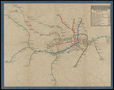
Underground Map of LondonDate/Date Range Produced: 1919 Language:English Dimensions: 26 cm. x 33 cm. folds to 14 cm. x 9 cm. Accession Number: OS-1919-25 Donor:Osher