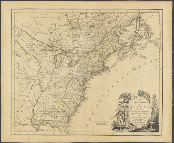
The United States of America laid down from the best Authorities, agreeable to the Peace of 1783. Published, April 3rd, 1783 by the Proprietor John Wallis, at his Map-Warehouse, Ludgate Street London.CreatorWallis, J. (John), -1818
PublisherWallis, J. (John), -1818
Date/Date Range Produced1814
LanguageEnglish
Region DepictedEastern CanadaEastern United StatesNortheastern StatesUnited States
Map TypeGeographicalPolitical maps
Dimensions46 x 55 cm
Printing ProcessEngraving
Material TypePaper
OCLC973940282
Accession NumberOML-1814-20
See AlsoThe United States of America laid down from the best Authorities, agreeable to the Peace of 1783. Published, April 3rd, 1783 by the Proprietor John Wallis, at his Map-Warehouse, Ludgate Street London.