

Before the American Revolution, Moosehead Lake was passed through by Europeans who followed Native American routes between the St. Lawrence and the Gulf of Maine. After the War of 1812-14, land speculators from Boston began to assess and divide up the land. But it was not until the 1820s, after Maine became a state, that permanent, non-Native American settlements were established and the region’s geography became fixed. The lands were assessed and surveyed anew with the economic resurgence of the region after 1880.
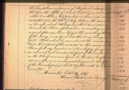
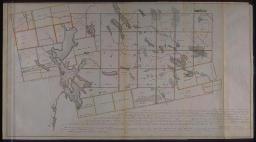
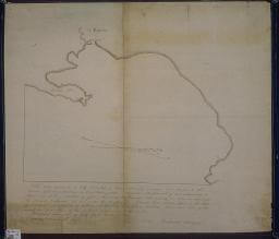
One provision of Maine’s 1820 separation from Massachusetts was the equitable distribution of unallocated lands between the two states. Joseph C. Norris and Hiram Rockwood were accordingly hired in 1827 to lay out the boundaries of new townships in the area between the West Branch of the Penobscot and the Kennebec. They ran a network of straight lines across the landscape, blazing the trees along each boundary. They were especially careful in blazing the trees at the corners of each township; they provided a list of the blazed corner-trees in their journal [5]. Norris compiled the surveyed lines into a general map of the area [4]. He made a clear distinction between the townships allocated to Massachusetts for sale (red) and those allocated to Maine (blue). Note that the Massachusetts townships have already been sold and their owners named on the map. For example, Sugar Island, in the southern half of Moosehead Lake, was bought by one E. Crehore [see 9b]. The townships outlined in yellow along the southern edge of the map represent pre-1820 land grants by Massachusetts. Such subdivision maps were used in the production of general maps of the new state, the most famous of which were those by Moses Greenleaf. More particularly, Hiram Rockwood prepared a tracing of his map of the Days Academy grant, and sent it to George W. Coffin in Boston [6]. Coffin perhaps used this data for his “Plan of the Public Lands in the State of Maine,” issued in August 1835; Henry David Thoreau used Coffin’s Map for his 1853 and 1857 trips through the Moosehead Lake region. Joseph Norris and Hiram Rockwood were not the first surveyors to map out townships near Moosehead Lake. After the Revolution, Massachusetts had sold off large tracts of land to pay off the debts it had incurred during the war. Notably, William Bingham had in 1793 purchased one million acres on both sides of the Kennebec, land which had been the object of speculation [8]. The Commonwealth had also given away land which was to be sold for the benefit of educational institutions and improvements.’ Several grants of land were made around Moosehead Lake to, for example, Days Academy, the Middlesex Canal, Bowdoin College, the Saco Academy, and Saco Free Bridge. These lands were identified and marked out on the ground in the 1810s. Thus, Thomas McKecknie demarcated the lands for the Taunton and Raynham Academy in 1813. The eastward distortions of Moosehead Lake on his map [7] clearly indicates that he surveyed the surrounding area by sketching it from atop the Blue Ridge, on the northern edge of the grant.
img/flat/mai04.jpg
Joseph C. Norris
Hiram Rockwood
Original field notes of the survey & description of Moosehead Lake and the Islands ... Book No.5 1827
Manuscript, 27.6 cm
Maine State Archive
img/flat/mai05.jpg
Joseph Norris
[Survey of the Undivided Lands]
1827
Colored manuscript, 102.0 x 55.8 cm
Maine State Archives
img/flat/mai06.jpg
Hiram Rockwood
Letter to George W. Coffin, with a Plan of Day's Acad[em]y
1829
Manuscript, 45.0 x 39.2 cm
Maine State Archives

img/flat/mai07.jpg
Tho[ma]s W. McKecknie
[Plan of half township of land given to the Inhabitants of Taunton and Raynham]
1820 handcolored manuscript copy of an 1813 manuscript survey plan, 52.4 x 40.0 cm
Maine State Archives

img/flat/mai08.jpg
Samuel Weston
Samuel Titcom
[Plan of William Bingham's Purchase]
1792
Ink on oilcloth, copy of manuscript map, 69.8 x 85.0 cm
Maine State Archives
Even as they divided up the land, the Norrises and other surveyors paid close attention to soil quality -- as an indicator of agricultural and therefore settlement potential -- and to the types and extent of the timber stands. This information drew speculators who were interested only in extending the timber industry of the Penobscot and Kennebec valleys. One of the earliest land speculators in the Moosehead Lake region was General Aaron Capen, from Dorchester, Mass. [26]. Accompanied by Aaron Jr., he examined the lower lake in 1830 and, while traveling south from an inspection of Days Academy, visited Deer and Sugar islands. Aaron Sr. purchased Deer Island in about 1832-34 and began to cut the virgin white pine [24a]. The island's strategic location halfway between Greenville and Mt. Kineo and its suitable deep water dock allowed the Capens to establish a successful way house, later a hotel and camps; a set of bound daily journals of Aaron Jr. from 1842 to 1875 outline the climatic conditions, activities, and guests [25a]. Thoreau writes of a discussion with General Capen, who indicated he had lost over $30,000 dollars in a land deal that involved buying Sugar Island from E. Crehore; the letters in Aaron Jr.'s leather wallet [24b] relate to the subsequent sale of Deer Island to cover the loss.

img/flat/unavailable.png
24a
Aaron Capen, Jr.
[Log for Timber Cutting on Deer Island and Vicinity]
Winter 1856-57
Manuscript, 20.4 cm
Hamilton Collection

img/flat/unavailable.png
24b
[Leather document holder with letters]
Aaron Capen, Jr., Deer Island, Moosehead Lake
July 11th, 1854
Made by C. A. Cobb, Lancaster, Mass.
10.0 x 18.5 cm
Hamilton Collection

img/flat/unavailable.png
25a
Aaron Capen, Jr.
[Daily journal for residence on Deer Island]
1856-57
20.4 cm
Hamilton Collection

img/flat/unavailable.png
25b
Lemuel Capen
Boston, May 5, 1853
Memorandum [May 5, 1853 to May 31, 1857]
21.5 cm
Hamilton Collection

img/flat/unavailable.png
26a
Philadelpia Mint?
Military gorget presented to Aaron Capen, promoted to Brigadier General in 1828
Coin silver and silver filigree
Hamilton Collection

img/flat/unavailable.png
26b
A. & G. Wellies
Coin silver pitcher owned by Aaron Capen
Engraved "IPC Dorchester, Mass 1828"
Hamilton Collection
William P. Oakes, from Sangerville, Me., was a state-registered (1870) land surveyor. His last map in the Maine State Archives is from 1912, by which time he had extended his landscape knowledge into successful land speculation and management. Shown here is his map of Greenville, from 1908 [12]. William personally trained his two sons, Louis and Harry, in land surveying and prospecting, and he pushed them through college. Louis Oakes studied forestry at the University of Maine; his first job was land surveying around Kittery. In about 1898, he began work for Hollingsworth & Whitney, surveying and assessing forest quality in the company's newly acquired properties west of Moosehead lake, completing at least 26 townships in seven years. In 1905-15, he worked as H&W's superintendent of operations. Shown here are a portrait [13] and a township map [14], from his H&W surveying years. He subsequently became a philanthropist, funded by the returns from his investments in his brother Harry's mining operations at Kirkland Lake, Ontario. Among many notable deeds, he bought Mt Kineo from Maine Central Railroad and restored the Kineo Annex as an hotel.

img/flat/mai13.jpg
W[illiam] P. Oakes
... Greenville As incorporated
1908
Ink on oilcloth, 32.3 x 26.7 cm
Maine State Archives

img/flat/unavailable.png
Photograph of Louis Oakes
1899
20.5 x 25.5 cm
Moosehead Marine Museum
Not illustrated on this website

img/flat/mai15.jpg
Louis Oakes
T6 R8 NWP Barnard Plantation & Williamsburg
1899
Ink on oilcloth, 49.5 x 43.1 cm
Maine State Archives
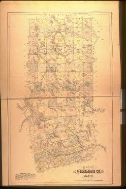
The popular late-nineteenth century county and state atlases were constructed from geographic data that was generally available. However, the more detailed maps of towns, with their indications of churches, stores, and professional offices, were harder to make because the compilers had to rely on correspondence and brief visits to each community. As a result, large-scale maps such as the two of Greenville and Greenville Junction shown here [15, 16], focus on the railroad center and not on the town. These images come from two atlases used at D. T. Sanders and Son's store in Greenville (not shown!), which also advertised in the rear of the atlases. More detailed county atlases were also produced by several commercial companies. The first of George Colby's atlases for Maine were of Piscataquis in 1882 [17] and Somerset in 1883 [18]. Considering that these are not the most populated counties in Maine, and would therefore provide a limited domestic market, Colby probably expected them to be bought by investors in the region's various timber operations.
img/flat/mai16a.jpg
30
Part of Greenville
In Stuart's Atlas of the State of Maine (South Paris, Maine: J. H. Stuart & Co., 1890)
Facsimile, 21.3 x 21.7 cm
Hamilton Collection

img/flat/mai18.jpg
Map of Piscataquis Co. Maine
In Atlas of Piscataquis County, Maine (Houlton and Dover, Me.: George N. Colby & Co., 1882)
Hand-colored lithograph, 60.5 x 36.5 cm
Hamilton Collection
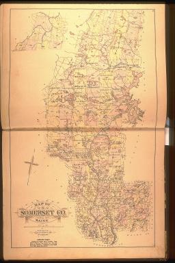
img/flat/mai19.jpg
Map of Somerset Co. of Maine
In Atlas of Somerset County, Maine (Houlton & Skowhegan, Me.: George N. Colby & Co., 1883)
Hand-colored lithograph, 60.1 x 37 cm
Osher Collection