

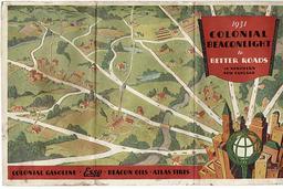
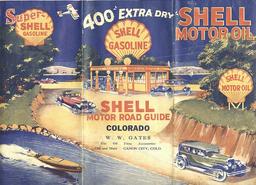
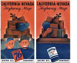
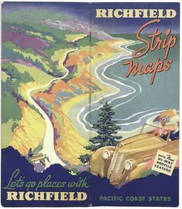
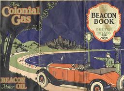
Road maps from an earlier day were a visual celebration of life on the motor trail. Their illustrations portrayed Americans, joy-filled and carefree, behind the wheel of a car: pushing seventy-five beneath an infinite azure sky, downshifting through tight esses on a winding country road or simply picnicking on a verdant hillside. Map covers were an exhilarating fresh air fiesta of the endless possibilities of motoring. Douglas Yorke, et. al., Hitting the Road, 1996 To sell their products, the oil companies used their road maps to promote motor travel by creating powerful, mythic images. They presented the motoring life as a great adventure and the road as a place of liberation and empowerment. Road map cover art stressed the allure of the open road. It turned the modern traveler into a frontiersman and explorer, subduing the wilderness through the progress of Yankee technology. (The use of historical imagery by the oil companies is discussed in a later section of this exhibition.) A Colonial-Beacon cover displayed the company icon, with rays of light showing the way and representing the radial roads that carry the motorist from the city to the fresh air of the country [15]. A 1928 Shell illustration equated the auto with a speedboat and airplane [16]. A whimsical Union ’76 cover showed vacationers setting out excitedly for the open road [17]. Sunrise Trails offered the romance and adventure of touring Long Island [18], while coursing the coastal highways in a convertible still proves irresistible today [19]. Can one improve on the excitement provided by the power of speedboats, diving airplanes, race cars, and fierce lions [20, 21]?
img/flat/roa14.jpg
1931 Colonial Beaconlight of Better Roads in Northern New England.
Chicago: Rand McNally and Company, 1931.
img/flat/roa16.jpg
Shell Motor Road Guide: Colorado.
Chicago: The H. M. Gousha Company for W. W. Gates, 1928.
img/flat/roa17.jpg
California-Nevada Highway Map.
Chicago: Rand McNally and Company for Union Oil Company, 1937

img/flat/unavailable.png
Sunrise Trails: Long Island.
New York: Redfield-Kendric-O'Dell Company for Long Island Hotel and Restaurant Association, Long Island, 1922.
img/flat/roa19.jpg
Richfield Strip Maps: Pacific Coast States.
Chicago: The H. M. Gousha Company for Richfield Oil Corporation, 1937.
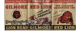
img/flat/roa20.jpg
Trails of the Red Lion.
Los Angeles: G. A. Eddy for Gilmore Oil Company, 1935.

img/flat/roa21.jpg
Richfield Motor Routes in New York, New England.
Chicago: Rand McNally and Company for Richfield Oil Corporation, 1930.
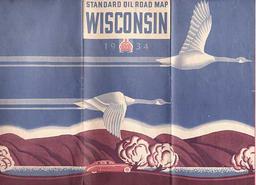
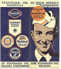
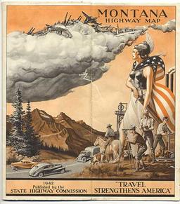
The linkage of the power of the automobile with freedom and adventure found still further expression in other road map covers: the art-Deco appeal of a sporty car on the open road [22], dramatic city skylines [23], a golden archer firing great arrows [24], and free-flying geese [25]. In 1929 a Standard attendant might have appeared at your service [26], but national service and a triumph of technological progress prevailed on patriotic covers during World War 2 [27; also 75 on opposite wall].
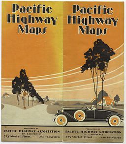
img/flat/roa22.jpg
Pacific Highway Maps.
San Francisco: Pacific Highway Association of California, 1928.
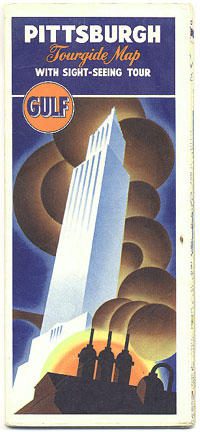
img/flat/roa23.jpg
Pittsburgh Tourguide Map with Sightseeing Tour.
Chicago: Rand McNally and Company for Gulf Oil Company, 1947.
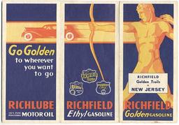
img/flat/roa24.jpg
Richfield Golden Trails in New Jersey.
Chicago: Rand McNally and Company for Richfield Oil Corporation, 1933.
img/flat/roa25.jpg
Standard Oil Road Map: Wisconsin.
Indiana: The H. M. Gousha Company for Standard Oil Company, 1934.
img/flat/roa26.jpg
Road Map of Washington: Standard Oil Company of California.
San Francisco: The Independent Press Room for Standard Oil Company, 1929.
img/flat/roa27.jpg
Montana: Highway Map.
Chicago: Rand McNally and Company for Montana State Highway Commission, 1942.
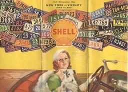
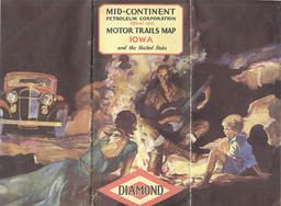
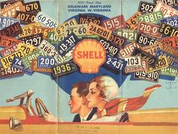
A 1933 Shell graphic used a collage of automobile number plates to suggest the wide ranging travel possibilities made available by the automobile [28]. Another cover, from a 1932 Diamond Oil map, displayed the pleasures of the camp fire, suggesting a return to frontier days, even as its verso image reassured the motorist that gas and help were still available, even in the wilds [29; see also 75 on opposite wall]. And at the end of the journey, when the motorist sought to return to urban civilization, he was once again guided by the Beacon [30, see 15].
img/flat/roa28.jpg
Shell Metropolitan Map: New York and Vicinity: Long Island.
Chicago: The H. M. Gousha Company for Shell Oil, 1933.
img/flat/roa29.jpg
Mid-Continent Petroleum Corporation Official 1932 Motor Trails Map: Iowa and the United States.
Chicago: Rand McNally and Company for Mid-Continent Petroleum Corporation, 1932.
img/flat/roa30.jpg
The Beacon Book of Better Roads for 1928.
Chicago: Rand McNally and Company for Beacon Oil Company, 1928.
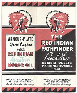
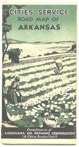
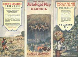
If most women portrayed on road maps bore a resemblance to a young Debbie Reynolds, then illustrations of men must have been clipped from Arrow Shirt adds. While the autos they drove and the clothes they wore change in timely fashion, their appearance as white Anglo-Americans is constant. Even service station attendants were represented as white males. Racial and ethnic minorities appeared infrequently. When they did, they were portrayed according to the stereotypes of the time. African Americans were never featured on covers but they did occasionally show up as field workers in the background; they served as scenery. A 1931 map of Arkansas portrayed Black women picking cotton in a stereotypical scene [32]. An earlier KYSO map of Georgia embodied all that is offensive to the present-day viewer: a cartoonish Black field hand - holding a watermelon, no less - contrasted sharply with a handsome, rugged and White male peach picker featured on the opposite panel [33]. The stereotypes held of Native Americans by the dominant White culture treated them as noble savages who had stepped aside to allow European Settlers to take their lands. In 1925, for example, Rand McNally depicted a Native blazing a trail for the whites to follow, even as it physically removed the Native from the mainstream path of progress embodied by the automobile [57, 100]. On the other hand, Native Americans commonly appeared in iconic form: White culture has long appropriated Native-related terms because of their connotations of heritage and rootedness; oil companies followed suit [31, 96].
img/flat/roa31.jpg
The Red Indian Pathfinder Road Map: Ontario, Quebec, Maritime Provinces 1940.
Montreal: McColl-Frontenac Oil Company Ltd., 1940.
img/flat/roa32.jpg
Cities Service: Road Map of Arkansas.
Chicago: Rand McNally and Company for Louisiana Oil Refining Corporation (A Cities Service Unit), 1931.
img/flat/roa33.jpg
Auto Road Map of Georgia: 1925 Edition.
Chicago: Rand McNally and Company for Standard Oil Company, 1925.
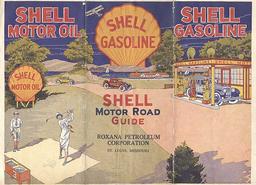
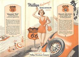
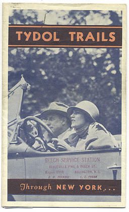
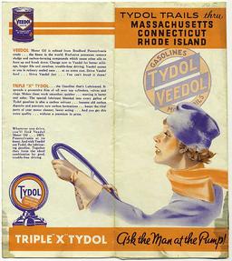
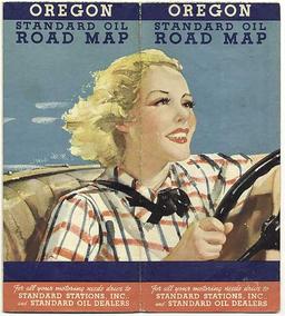
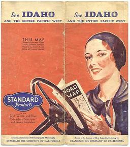
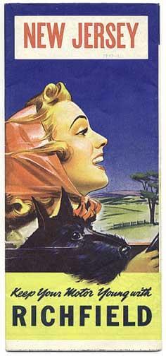
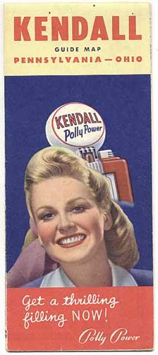
When women were depicted on the covers of road maps, they were generally shown in passive or domestic roles, most commonly as passengers being driven by their husbands [e.g., 17, 19, 22, 57, and, in the case behind you, 97, 98, 99]. Oil companies were slow to acknowledge, in their road maps at least, the increasing autonomy of women in the 1920s. It was not until 1927 that a Shell map portrayed a woman in an active role, intruding into the male realm of golf [34]. In 1931, an avant garde map photographed a woman driving a man [36] while another depicted a woman driving by herself and reading a road map [40]. Thereafter, a number of road maps showed women "taking the wheel" from their male counterparts [28, 38, 39, 41; also 102 in the center case at the end of the gallery]. Women's new-found autonomy was not complete, however. They continued to be used as a marketing tool [35], while one map cover suggested the beginning of the stereotype of the "woman driver" [37]. Their autonomy was also short-lived, with women being shunted back into domestic roles by 1950; even so, the oil companies still had to acknowledge women as a force in purchasing their products [42].
img/flat/roa34.jpg
Shell Motor Road Guide.
Chicago: Rand McNally and Company for Roxana Petroleum Corporation, 1927.
img/flat/roa35.jpg
Phillips Highways of Wisconsin, 1933.
Chicago: The H. M. Gousha Company for Phillips Petroleum Company, 1933.
img/flat/roa36.jpg
Tydol Trails through New York.
Rogers-Kellogg-Stilson Company, for Tide Water Oil Company, 1931.
img/flat/roa37.jpg
Tydol Trails through Massachusetts, Connecticut, Rhode Island.
Chicago: The H. M. Gousha Company for Tide Water Oil Company, 1935.
img/flat/roa38.jpg
1932 Road Map: Delaware, Maryland, Virginia, West Virginia.
Chicago: The H. M. Gousha Company for Shell Oil Company, 1932.
img/flat/roa39.jpg
Oregon: Standard Oil Road Map.
Chicago: The H. M. Gousha Company for Standard Oil Company, 1936.
img/flat/roa40.jpg
See Idaho and the Pacific West.
San Francisco: Rand McNally and Company for Standard Oil Company, 1931.
img/flat/roa41.jpg
New Jersey.
Chicago: Rand McNally and Company for Richfield Oil, 1939.
img/flat/roa42.jpg
Kendall Guide Map: Pennsylvania, Ohio.
Chicago: The H. M. Gousha Company for Kendall Refining Company, 1950.