

When the start of the twentieth century brought the automobile, it soon became evident that the existing bicycle and railroad maps would not serve well for this new form of transportation. Color overprints of auto roads on these maps caused cartographic confusion. A better method of mapping the road was needed. The very first auto guides provided extensive description in text form only, so that even a simple trip required reading a book! This cumbersome format was soon replaced by more practical guides with strip maps of principal routes, keyed to descriptions of hotels, gas stations, mechanics, and other locations essential for the early auto traveler. Well-known artists were commissioned to do the vivid graphics. This popular and enduring format was pioneered by the “Blue Book” series of the American Automobile Association (AAA), which began in 1906 [85]. These books also included full color regional maps tipped into the inside covers [86]. Their publication costs were partially met by oil company advertisements. However, AAA’s over-the-counter sales of their regional map series did not survive the 1920s [87].

img/flat/roa85.jpg
The Official Automobile Blue Book: Volume Three- Delaware, Maryland, New Jersey, Pennsylvania, Virginia and West Virginia.
Chicago and New York: The Automobile Blue Book Publishing Company for American Automobile Association, 1916.
img/flat/roa87.jpg
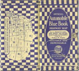
Official Automobile Blue Book Highway Map: No. 5- Pennsylvania, New Jersey, Delaware, Maryland and Washington, D.C.
Chicago and New York: Automobile Blue Books, Inc. for American Automobile Association, 1927.
Special guides, such as those of Pine Tree Tours, targeted tourism, which at the time seemed to be the raison d'etre for the automobile [88, 89]. The Automobile Legal Association (ALA) offered similar fare in their "Green Book" series; their maps were less sophisticated, lacking color [90, 91]. The National Automobile Association, another rival company, emphasized strip maps over text [92]. As early as 1914, the National Survey Company (actually a private company) produced a series of regional guides that resembled bicycle guides in format. They nonetheless proved to be popular with automobilists [93, 94].

img/flat/roa88.jpg
Maine Automobile Road Book and Pine Tree Tour of Maine and White Mts.
Portland, Maine: Maine Automobile Association, Tourist Information Bureau, 1914.

img/flat/roa89.jpg
Maine Automobile Road Book: For Motoring in Northeastern United States and Eastern Canada.
Portland, Maine: Maine Automobile Association, Touring Bureau, 1918.
img/flat/roa90.jpg
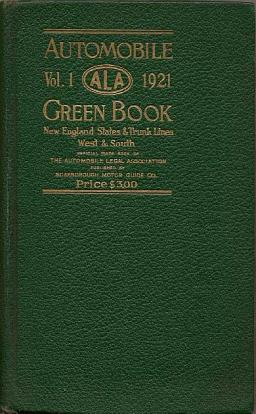
The Automobile Green Book: Volume 1- New England States and Trunk Lines West and South.
Boston: Scarborough Motor Guide Company, 1921.
img/flat/roa91.jpg
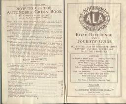
The Automobile Green Book: Road Reference and Tourists' Guide of all States East of Mississippi River, Eastern Ontario, Quebec, and Maritime Provinces.
Boston: Scarborough Motor Guide Company, 1932.

img/flat/roa92.jpg
Mixer's Road Guide and Strip Maps: A Book of Routes Tours and Points of Interest for New York State, New England, Lower Canada, New Jersey, Pennsylvania, Southeastern States and Florida.
New York: New England Hotels Publishing Corporation for National Automobile Association, 1926.

img/flat/roa93.jpg
The Official Maps of New England. Chester, Vermont : National Survey Co., 1914. 94. The Official Maps of New England.
Chester, Vermont: National Survey Co., ca.1924.
Rand McNally attempted to cover all the bases with its air, rail, and road guide [95]. Some oil companies offered guides for free; McColl Frontenac's Red Indian Guide combined photographic scenes with maps and description [96].

img/flat/roa94.jpg
Standard Indexed and Air Trails Maps of Mississippi: For Tourists, Aviators, Commercial Travelers, Transportation Men, Shippers, General Commercial and Business Reference.
Chicago: Rand McNally and Company, 1929.

img/flat/roa95.jpg
Briggs. A. A.
Blazing the Red Indian Trail: Let the Red Indian be your Guide.
Toronto: A. A. Briggs, 1934.
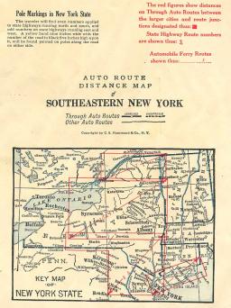
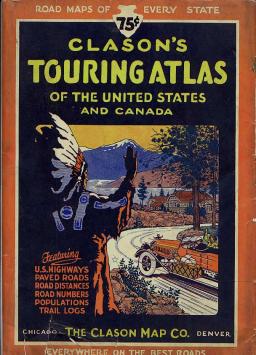
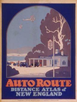
By the 1920s, commercial publishers such as Rand McNally had dropped the text almost completely from the guides to produce the modern road atlas. Indeed, Rand McNally is synonymous with large-format road atlases [97]. First published in 1925, these atlases still have a similar form today. Yet, Rand McNally was not alone: Hammond and Gallup produced their own road atlases, each with its own identifiable characteristics [98, 99]; Clason offered an atlas featuring spectacular cover graphics that seemed particularly suited to the West [100]; Jenney issued a free Eastern equivalent with covers in Art Deco style [101].
img/flat/roa96.jpg
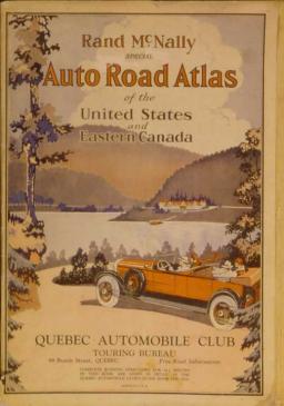
Rand McNally Special Auto Road Atlas of the United States and Eastern Canada.
Chicago, San Francisco, New York: Rand McNally & Company, 1929.
img/flat/roa97.jpg
Auto Route Distance Atlas of Maryland, Delaware, Pennsylvania, New York, and New Jersey.
New York: C.S. Hammond & Co. for York Trust Company, 1924.
img/flat/roa99.jpg
Clason's Touring Atlas of the United States: With Road Maps of Every State and Ontario and Quebec, Canada.
Denver, Chicago: The Clason Map Company, 1927.
img/flat/roa101.jpg
Auto Route Distance Atlas of New England.
Boston: C. S. Hammond & Company for Jenney Manufacturing Company 1934.
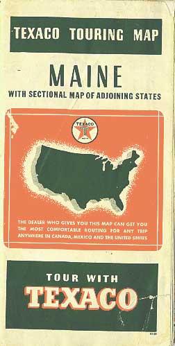
Local gasoline distributors paid for the road maps which would be given away to motorists. They selected the maps that their stations would stock from bound atlases of samples provided by sales representatives from the oil companies. Shell's 1933 compilation made a handy and detailed national atlas for someone [102]. A similar offering from 1938 likely represents the largest item in the road map arena. This bound volume measures a generous 28 x 22 inches and contains the full array of fifty-four North American road maps that Texaco would offer that year [103]. Bearing the name and imprint of Lucien D. Barrows, chief engineer of the Maine Highway Department, this complementary atlas was apparently sent so that the maps might be verified before they were issued to the public [104, 105, 106].
img/flat/unavailable.png
Shell Salesman's Atlas.
Chicago: The H. M. Gousha and Company for Shell Oil, 1936.

img/flat/unavailable.png
Texaco Composite Atlas.
Chicago: Rand McNally and Company for Texaco,1938.
img/flat/roa104.jpg
Texaco Touring Map: Maine with Sectional Map of Adjoining States.
Chicago: Rand McNally and Company for Texaco, 1938.

img/flat/roa107.jpg
Tydol Trails Thru New England.
Chicago: Rand McNally and Company for Tide Water Associated Oil Company, 1928.