
Road maps show history in the context of the land and are invaluable in recording the changes wrought by the automobile. Furthermore, some road map covers depicted contemporary events of historical note: a 1928 Tydol issue depicted the Byrd Antarctic Expedition and the Graf Zeppelin, both on the same cover [107]; another Tydol map of the previous year included a drawing of the world’s first traffic light, on New York’s Fifth Avenue [108].
img/flat/roa109.jpg
Tydol Trails Thru New England.
Chicago: Rand McNally and Company for Tide Water Associated Oil Company, 1927.
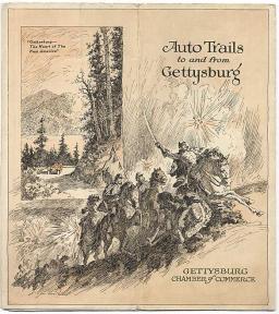
Oil companies used historical events to promote travel, and therefore increase sales of their products, thereby reinforcing the mythic imagery of the automobile. A 1941 road map used the venerable device of drawing a curtain back to reveal the stage of history, and showed an automobile driving right into the past: the map would lead the tourist to sites of historic interest, such as old forts and former mining towns [107]. Oil companies often provided colorful special inserts that served as historic and scenic guides [110, 112, 113]. A 1925 map guide offered historic tours in "Soconyland" which, in this instance, comprised much of the Northeast [109]. Other maps commemorated past events, such as a 1932 Standard Oil map of Pennsylvania which plotted the travels of George Washington [114]. (Coincidentally, the National Geographic Society also produced their map version of the same theme that year.) One of the more dramatic examples of cover art appeared in 1925, to honor the events of the battle of Gettysburg [115]. Finally, past events were shown on a few road map covers as part of the mythic recreation of the modern motorist as an explorer and conqueror. A colorful 1931 Parco map, for example, improbably depicted Spanish "discoverers" or conquistadores making landfall, map in hand . . . but in Nebraska? [116].
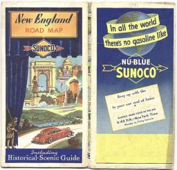
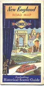
img/flat/roa110.jpg
New England Road Map: Including Historical - Scenic Guide.
Chicago: Rand McNally and Company for Sun Oil Company (Sunoco), 1941.
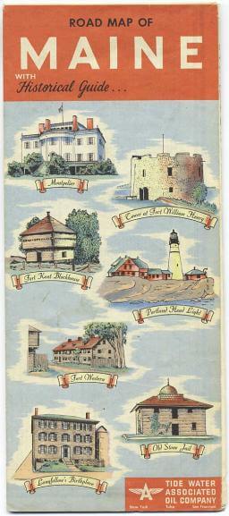
img/flat/roa111.jpg
Road Map of Maine with Historical Guide.
Chicago: The H. M. Gousha Company for Tide Water Associated Oil Company, 1952.
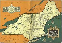
img/flat/roa112.jpg
Historic Tours in Soconyland.
New York: Standard Oil Company, 1925.

img/flat/roa113.jpg
Delaware, Maryland, Virginia, West Virginia: Road Map with Pictorial Guide.
Convent Station, New Jersey: General Drafting Company, for Esso Oil Company, 1952.
img/flat/roa114.jpg
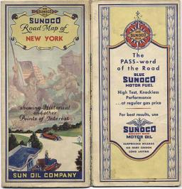
Sunoco Road Map of New York Showing Historical and Other Points of Interest.
Chicago: Rand McNally and Company for Sun Oil Company (Sunoco), 1930.

img/flat/roa115.jpg
Map of the Principal Events in the Life of George Washington.
New York: General Drafting Company for Standard Oil Company, 1932.
img/flat/roa116.jpg
Auto Trails to and from Gettysburg.
Chicago: Rand McNally and Company for Gettysburg Chamber of Commerce, 1925.

img/flat/roa117.jpg
Nebraska: Parco Motor Trails Map.
Minneapolis: Langwith for Producers and Refiners Corporation, (Parco), 1931.