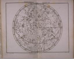

Since before recorded history, humans have observed the motions of the stars, trying to figure out where they were. Eventually, they made physical models of the night sky: that is, globes and celestial maps. The first recorded celestial globe in Greece was made in the 5th century bce and in China during the 2nd century BCE. In the European Renaissance, celestial maps comprised mixtures of astronomical observations and artistic expression, reflecting Classical, Islamic, and popular artistic themes of the day. Crucially important in this respect was the work of Albrecht Dürer, whose combined scientific and artistic celestial maps were first published in 1515. Dürer’s work was then copied by artists and astronomers throughout Western Europe until the middle of the sixteenth century. Celestial maps were included in many general and dedicated atlases in response to popular demand (76,77). Late seventeenth-century astronomers, notably John Flamsteed, sought to increase the amount of factual information in star charts (78). Although Flamsteed’s work continued to represent the constellations artistically, the artistic tradition in astronomy thereafter declined. During the nineteenth century, astronomers rejected the celestial map in favor of the more accurate star catalogue. The celestial map became the property of the collector, not the scholar, though scholars and laymen alike would still collect and treasure both celestial/terrestrial globes and celestial maps up to the present day.

/map/4351.0001
Antonio Zatta
Italian, fl. 1775-1797
Planisferio celeste settentrionale tagliato sull'Equatore | Vennezia
Copper engraving, hand colored, 31 x 41cm
From: Atlante Novissimo, Tomo I (Venice, 1779)
Smith Collection

/map/4103.0012c
Pieter Schenk
German, 1645-1715 [Sr.] or ca.1698-1775 [Jr.]
Planisphærium
Copper engraving, hand colored, 48 x 55.5cm
From: an untitled composite atlas of maps, ca. 1600-1718, perhaps assembled ca. 1840
Smith Collection

/map/2051.0001
["Moyens de connoître les constellations"; Hemisphère Boréal; Andromede, Persée, Le Triangle]
Text and two copper engravings, each 18 x 23cm
From: J. Fortin, Atlas Céleste de Flamstéed, publié en 1776, edited by Joseph Jérome le Français de Lalande and Pierre Méchain, 3d edition (Paris: Lamarche, 1795)
Smith Collection

/map/2051.0001
["Moyens de connoitre les constellations"; Hemisphere Boreal; Andromede, Persée, le Triangle]
Manuscript text and two maps, 18cm diameter and 18 x 23cm, respectively
From: "Atlas Celeste de Flamsteed," an undated and unsigned manuscript.
Smith Collection