

Collection: Osher Map Library Collection
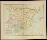
Name: Iberia vel Hispania
Barcode:
Image Number:
Creator:
Publishing Location:
Notes: This map may have come from a school geography. The date is an approximation. Map shows Hannibal's route from Carthage into the Alps and over the Pyrenees to northern Italy.
Date/Date Range Produced:
Date/Date Range Published:
Language:
Dimensions: 22 x 30
Physical Description: 1 map: colored, illustrated
OCLC: 610055295
Accession Number: OML-1875-40
Permanent URL: