

Collection: Osher Map Library Collection
Name: Waterman's Pacific View Map of the World
Barcode:
Image Number:
Creator:
Publishing Location:
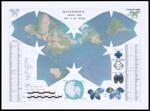
Notes: Waterman projection. Includes inset of Antarctic region, table listing countries and capitals of the world and 7 illustrations. Note: "Copyright July 2010."
Date/Date Range Produced:
Date/Date Range Published:
Language:
Dimensions: 58 x 78
Physical Description: 1 map: color, illustrated
OCLC: 668088589
Accession Number: OML-2010-1
Permanent URL: