Sort By:
CreatorDes Barres, Joseph F. W. (Joseph Frederick Wallet), 1729-1824
PublisherDes Barres, Joseph F. W. (Joseph Frederick Wallet), 1729-1824
SurveyorHolland, Samuel, 1728-1801
LanguageEnglish
Region DepictedFloridaGeorgiaSouth Carolina
Map TypeGeographical
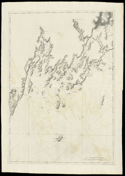
DimensionsChart: 75.5 x 60 cm on sheet: 76.5 x 63 cm
Printing ProcessEngraving
Material TypePaper
LC Call NumberG3911 .D4 1779
OCLC226393176
Accession NumberSM-1779-7
See AlsoA Chart of Delawar Bay.Chart of Coast from Pemaquid Point to Owl's Head Bay [sheet 1 of 2]Chart of Coast from Pemaquid Point to Owl's Head Bay [sheet 2 of 2]Chart of Coast from Pemaquid Point to Owls Head BayChart of Falmouth HarbourChart of Falmouth HarbourChart of Falmouth HarbourChart of Grand Manan IslandChart of Passamaquody BayChart of Penobscot Bay (Upper Part)Chart of the Coast from Burntcoal Island to Skulock PointChart of the Coast from Cape Elizabeth to Musketo Island Chart of the Coast from Cape Elizabeth to Musketo IslandChart of the Coast from Musketo Island to Skuttock PointChart of the Coast Goldsborough to Moose Harbor [Sheet 2 of 3]Chart of the Coast Goldsborough to Moose Harbor [Sheet 3 of 3]Chart of the Coast Goldsborough to Moose Harbor. [Sheet 1 of 3]Chart of the Coast Goldsborough to Moose HarbourChart of the Entrance into Penobscot BayChart of the Entrance into Penobscot BayChart of the Harbours and Rivers between Portland Point and Stage IslandChart of the Harbours and Rivers between Portland Point and Stage IslandCharts of the Coast and Harbors of New England [...] [Title page]Coast from Newbury to Cape ElizabethNotes Biographical and Bibliographical on The Atlantic NeptuneNotes Biographical and Bibliographical on The Atlantic Neptune [Front cover]The Coast of New England.Views: (I) Mechios River near the Mills. (II) A Sketch of Mechios Mills[Boston Harbor Chart Des Barres] [facsimile][Coast of Maine - from Spurwink River to Moose Point] [or, from Musketo Island to Cape Elizabeth, including Kennebec River] [facsimile][Coast of Maine - Two Views of Wolves Islands at Entrance of Passamaquoddy Bay]
DonorSmith
SubjectsAmerican Revolution, 1775-1783Maine--MapsMaps--Early works to 1800
CreatorDes Barres, Joseph F. W. (Joseph Frederick Wallet), 1729-1824
PublisherDes Barres, Joseph F. W. (Joseph Frederick Wallet), 1729-1824
SurveyorHolland, Samuel, 1728-1801
LanguageEnglish
Region DepictedFloridaGeorgiaSouth Carolina
Map TypeGeographical
DimensionsChart: 75.5 x 60 cm on sheet: 76.5 x 63 cm
Printing ProcessEngraving
Material TypePaper
LC Call NumberG3911 .D4 1779
OCLC226393176
Accession NumberSM-1779-7
See AlsoA Chart of Delawar Bay.Chart of Coast from Pemaquid Point to Owl's Head Bay [sheet 1 of 2]Chart of Coast from Pemaquid Point to Owl's Head Bay [sheet 2 of 2]Chart of Coast from Pemaquid Point to Owls Head BayChart of Falmouth HarbourChart of Falmouth HarbourChart of Falmouth HarbourChart of Grand Manan IslandChart of Passamaquody BayChart of Penobscot Bay (Upper Part)Chart of the Coast from Burntcoal Island to Skulock PointChart of the Coast from Cape Elizabeth to Musketo Island Chart of the Coast from Cape Elizabeth to Musketo IslandChart of the Coast from Musketo Island to Skuttock PointChart of the Coast Goldsborough to Moose Harbor [Sheet 2 of 3]Chart of the Coast Goldsborough to Moose Harbor [Sheet 3 of 3]Chart of the Coast Goldsborough to Moose Harbor. [Sheet 1 of 3]Chart of the Coast Goldsborough to Moose HarbourChart of the Entrance into Penobscot BayChart of the Entrance into Penobscot BayChart of the Harbours and Rivers between Portland Point and Stage IslandChart of the Harbours and Rivers between Portland Point and Stage IslandCharts of the Coast and Harbors of New England [...] [Title page]Coast from Newbury to Cape ElizabethNotes Biographical and Bibliographical on The Atlantic NeptuneNotes Biographical and Bibliographical on The Atlantic Neptune [Front cover]The Coast of New England.Views: (I) Mechios River near the Mills. (II) A Sketch of Mechios Mills[Boston Harbor Chart Des Barres] [facsimile][Coast of Maine - from Spurwink River to Moose Point] [or, from Musketo Island to Cape Elizabeth, including Kennebec River] [facsimile][Coast of Maine - Two Views of Wolves Islands at Entrance of Passamaquoddy Bay]
DonorSmith
SubjectsAmerican Revolution, 1775-1783Maine--MapsMaps--Early works to 1800
![[Coast of Maine - Two Views of Wolves Islands at Entrance of Passamaquoddy Bay]](https://cdn1.historyit.com/iiif/2/5f34291499c4a6.60628694/660c05f5428561.90663406.jpg/full/!600,600/0/default.jpg?no_errors=1)
CreatorDes Barres, Joseph F. W. (Joseph Frederick Wallet), 1729-1824
PublisherDes Barres, Joseph F. W. (Joseph Frederick Wallet), 1729-1824
SurveyorHolland, Samuel, 1728-1801
LanguageEnglish
Region DepictedFloridaGeorgiaSouth Carolina
Map TypeGeographical
DimensionsChart: 75.5 x 60 cm on sheet: 76.5 x 63 cm
Printing ProcessEngraving
Material TypePaper
LC Call NumberG3911 .D4 1779
OCLC226393176
Accession NumberSM-1779-7
See AlsoA Chart of Delawar Bay.Chart of Coast from Pemaquid Point to Owl's Head Bay [sheet 1 of 2]Chart of Coast from Pemaquid Point to Owl's Head Bay [sheet 2 of 2]Chart of Coast from Pemaquid Point to Owls Head BayChart of Falmouth HarbourChart of Falmouth HarbourChart of Falmouth HarbourChart of Grand Manan IslandChart of Passamaquody BayChart of Penobscot Bay (Upper Part)Chart of the Coast from Burntcoal Island to Skulock PointChart of the Coast from Cape Elizabeth to Musketo Island Chart of the Coast from Cape Elizabeth to Musketo IslandChart of the Coast from Musketo Island to Skuttock PointChart of the Coast Goldsborough to Moose Harbor [Sheet 2 of 3]Chart of the Coast Goldsborough to Moose Harbor [Sheet 3 of 3]Chart of the Coast Goldsborough to Moose Harbor. [Sheet 1 of 3]Chart of the Coast Goldsborough to Moose HarbourChart of the Entrance into Penobscot BayChart of the Entrance into Penobscot BayChart of the Harbours and Rivers between Portland Point and Stage IslandChart of the Harbours and Rivers between Portland Point and Stage IslandCharts of the Coast and Harbors of New England [...] [Title page]Coast from Newbury to Cape ElizabethNotes Biographical and Bibliographical on The Atlantic NeptuneNotes Biographical and Bibliographical on The Atlantic Neptune [Front cover]The Coast of New England.Views: (I) Mechios River near the Mills. (II) A Sketch of Mechios Mills[Boston Harbor Chart Des Barres] [facsimile][Coast of Maine - from Spurwink River to Moose Point] [or, from Musketo Island to Cape Elizabeth, including Kennebec River] [facsimile][Coast of Maine - Two Views of Wolves Islands at Entrance of Passamaquoddy Bay]
DonorSmith
SubjectsAmerican Revolution, 1775-1783Maine--MapsMaps--Early works to 1800