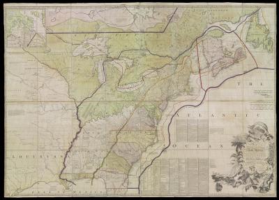
John Mitchell and William Faden, Hand-colored Copper Engraving, London, 1775John Mitchell’s map was the only map consulted during the negotiations preceding the Treaty of Paris in 1782-1783. Several editions of the map were annotated with boundary lines marked in red ink. In 1934, Col. Lawrence Martin, then chief of the Library of Congress Geography and Map Division, called Mitchell’s map, “the most important map in American history.”
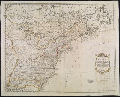
Thomas Kitchin and Thomas Cadell, Hand-colored Copper Engraving, London, 1783
This was one of the first maps published after the American Revolution. It presents the former colonies, early settlements, forts, Native America villages, and fishing banks.