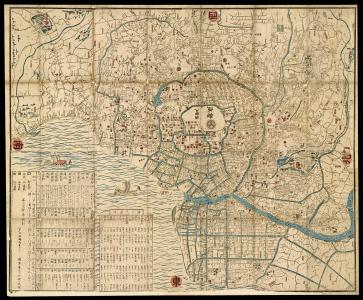

The Edo Period (or Tokugawa Period), was a time of great stability and cultural preservation in Japan, lasting from 1603 to 1868. Tokugawa Ieyasu, the founder and first shogun of the Tokugawa shogunate, was extremely suspicious of foreigners. He permitted only Chinese and Dutch merchants to land and trade in Nagasaki, in an attempt to prevent outsiders from influencing Japanese culture. Thus, Chinese and Dutch cartography alone influenced Japanese mapmakers. Publishers were highly regulated by the shogunate’s guilds, and operated mainly out of the three cities; Kyoto, Edo and Osaka. Thus, maps from this period are marked by strong social hierarchies, Buddhist narratives, and traditional Japanese landscapes; a reminder that for almost three centuries, the purity of Japanese cartography and art was well preserved.