

Collection: Osher Map Library Collection
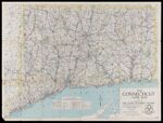
Name: The Connecticut guide map : a project of the State Planning Board ; initiated under CWA & completed with FERA funds
Barcode:
Image Number:
Publisher:
Date/Date Range Produced:
Date/Date Range Published:
Physical Description: 1 map : col. ; 73 x 98 cm., folded to 26 x 13 cm
OCLC: 55964739
Accession Number: OML-1935-80
Donor:
Permanent URL: